Tuesday March 3, 2020 – Arica, Chile
Arica (the city of eternal spring) with its 230,000 people is the northernmost City in Chile some 12 miles or 1/2 hour drive from the Peru border and 45 minute drive to the Bolivian border. The city was part of Peru until 1880 when the Peruvian forces on June 7, 1880 failed to keep control of the fort at the top of the El Moro headland (361 feet) and thus lost the war of the Pacific and Arica itself became Chilean.
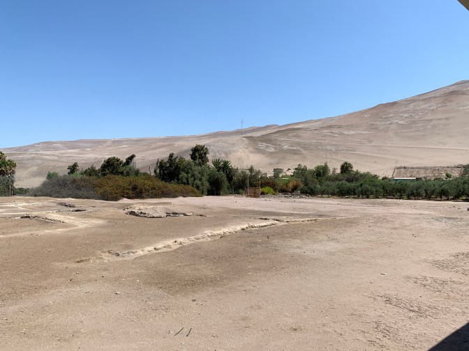
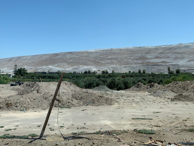
It is in the Atacama desert which is the driest desert in the world receiving officially 0.0025 millimeters of rain a year or in some places it rains a couple of times each 100 years! Nothing other than sand is in this desert. The Atacama starts at the Peruvian border and runs some 1,000 miles south almost to Valparaiso (our prior stop). However, there is a tremendous contrast as there are two valleys (Azapa and Rio Lolita) that have rivers along which they produce three crops of tomatoes a year, corn citrus and olive trees. Indeed these are an important part of the export economy. Arica is “just the other side of the Andes” from The Amazon. In these latitudes, the prevailing winds are from East to West (opposite one Southern Chile) so all the rain drops in the Amazon and does not make it across the Andes. Furthermore, the cold Humboldt Current coming up the Pacific Ocean from Antarctica cools down any moist air causing a morning haze or fog, but no precipitation. However, there is a small valley in the Andes where one town (Putre) at 4,000 meters above sea level (13,125 feet) where it rains every day. This leads to water and rivers flowing to the Pacific. They are mostly piped underground and the farmers along the valleys draw water for their crops. All who live in this area of the rivers are farmers of some sort. Some live in expensive and very valuable homes, while others live in modest homes, by choice, even though they are very wealthy.
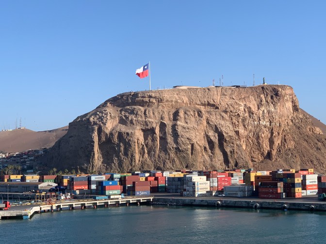
The most striking feature as one enters the Harbour is the precipitous headland – El Moro, on top of which there was a Fort, now a small museum and a great view of the city.

The Andes extend 5,000 miles down western South America, with Ecuador, Peru and Chile on the West and all the other countries to the East side of the Andes. Aconcagua in Argentina is the highest peak at 22,834 feet and Nevada Ojos del Salgado at 22,615 feet being the highest in Chile. The mountains have lead over the years to the isolation of Chile.
The Arica region was inhabited from at least 3000 BCE / BC with some evidence dating to 11,000 BCE / BC, with various tribes (we saw mummies from this period) but its modern history dates to 1565. This was a small settlement used for the embarkation if Silver from the Potosi mines. Sir Francis Drake in “The Golden Hind” plundered Arica snd it’s silver in 1578 and died and is buried here after fleeing other raids further north.
Since there are a lot of volcanos in the region and many earthquakes (a 6 earthquake yesterday for example) with several in the 17th century devastating the city.
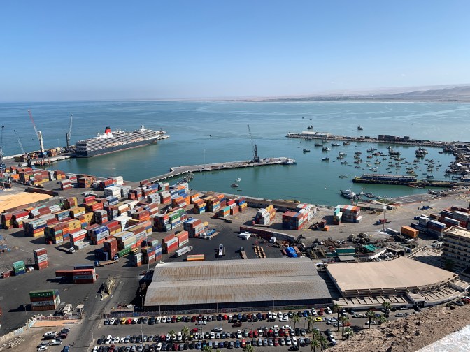
During the War of the Pacific (1879-84) between Chile, Peru and Bolivia, Chile beat the Peruvian forces, thus Arica became part of Chile in 1880, but many disputes followed, so it was not until 1929 that Arica officially became part of Chile. Bolivia as part of this trilateral truce agreement (they needed land in the ocean) it was agreed that Arica would serve as the port for Bolivia, which remains to thus day. The majority of the port activity is related to Bolivian interests. In 1913 a rail service to La Paz, Bolivia was completed which helped the Arica port economy. In 1953 Arica became a Free Port.
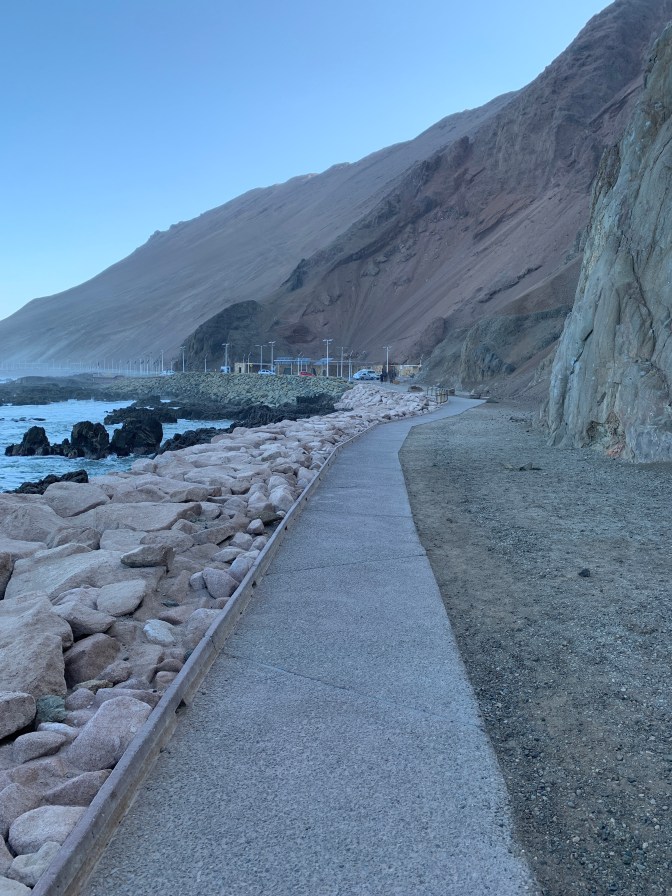
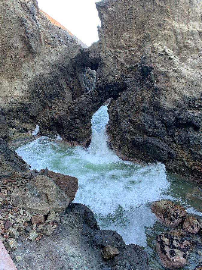
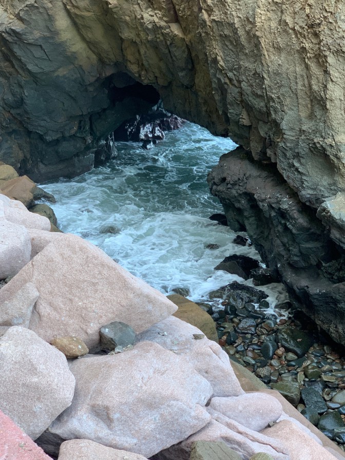
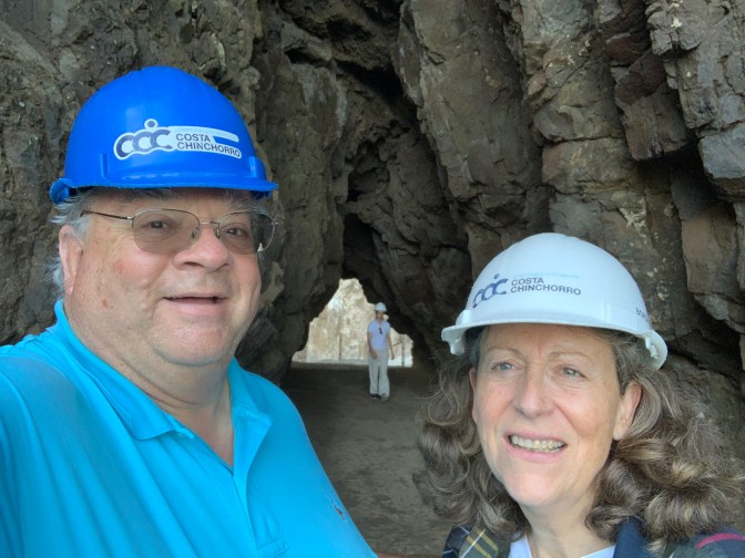
We met our guide Daniela and driver Jaime R. Gonzalez (jamieegonzalez.a12@gmail.com +569-9774-9730 OR +569-6517-4250) at the quayside – Port to Dock, Starboard to town (after viewing an amazing sunrise) and after deciding on a plan for the day headed off past the Golden Omega Fish Meal factory – one of the largest employers, to The Anzota caves and walk. We donned our hard-hats as there was a danger of falling rocks from the cliffs. We embarked on our 1 mile walk along a well established pathway (completed in 2017) at the base of very high cliffs and above high water. Thus most of the time we had these 300-800 meter (1000-2600 feet) almost vertical (42-85 degree angle) high rock face on one side filled with caves (many of which have 2000 year old pictographs on the walls now spoiled by modern graffiti) and the rocky shoreline on the other. The caves were naturally formed by wave action and were both inhabited as well as serving as burial places for the local Chinchorro culture inhabiting the area. From a Geomorphology standpoint this sector of the Anzota caves correspond to the “Farellón Costero de la Cordillera de la Costa” (Coastal mountain range cliff). Numerous sea animals were present that covered the cliffs with Guano (from Quechua “wanu” = marine bird excrement). Experienced entrepreneurial workers up until 1970 would remove thus guano and sell it to the local farmers and even export it out of the area. Natives (usually 2-4 at a time with 20-30 mikes) from the neighboring communities – Codpa, Belén, Ticnamar and Cobija woul spend up to 8-10 months lowering themselves or climbing a rope with a pick axe and sack working the cliff and filling the sacks. These would then be carried by the mules back to the towns and sold or used. In one particular place, two large rocks formed a 2 foot opening for the waves to pass through. As the wave retreated it moved a large number of 1 inch type of sized pebbles causing an interesting sound like a baby’s rattle. Various figures could be seen (a few with imagination) in the folds of the bricks, like faces, animals etc. We were both left amazed by the beauty of nature. As we were leaving, a bus from the ship arrived, so we were glad to have the awe inspiring place to ourselves for the 45 minutes we were there.

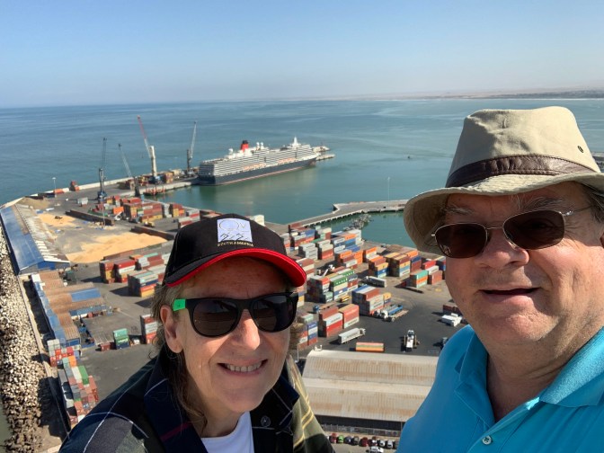
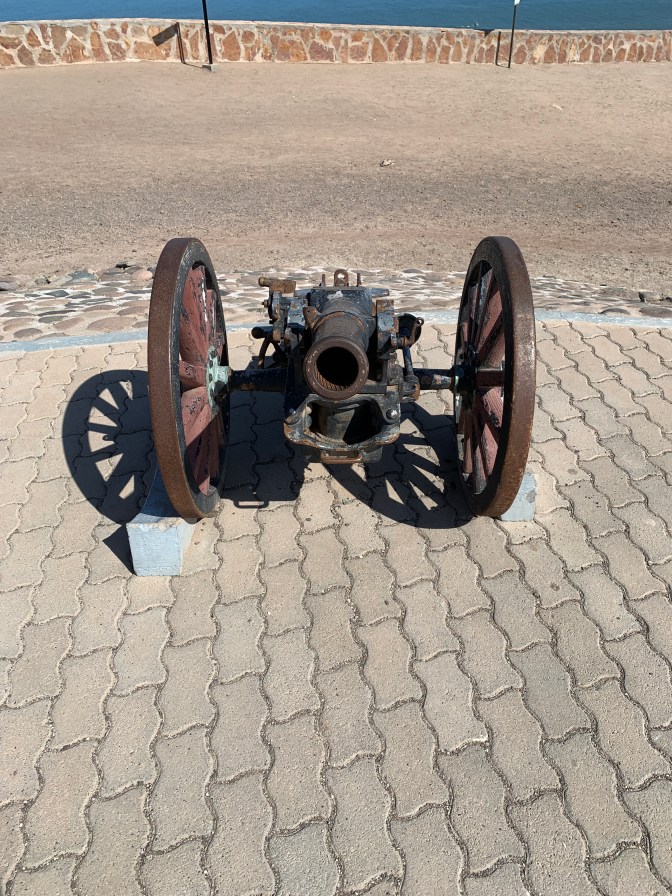
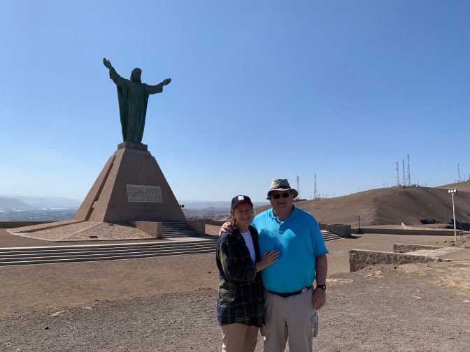
Returning to Arica we passed the poorer zone where we saw the 3 bedroom, 1 bathroom government housing for the underprivileged. These looked much better than in other places and the owners were able for a modest sum buy their homes and pass them on to the next generation or sell them. This provided for pride in ownership. The climb through this area to the summit of El Moro headland to see the panoramic view of the city and bays, the military museum (the sign outside the museum had our guide Daniela lying on a cannon as part of publicity work she did a few years ago), the tomb of the unknown soldier (dedicated by President Pinochet on June 7, 1980 – the centennial anniversary) and the Christ of peace with open arms statue. This statue symbolizes the peace between Chile and Peru is 11 meters (36 feet) tall and 9.2 meters (30 feet) wide with an internal steel structure weighing a total of 15 tons. It was sculpted in Spain, brought to Arica in 1987 and inaugurated in it’s present position on November 22, 1999. The base has the “coat of arms” of each country and the saying “Amaos los unos a los otros como yo os he mandado” (Love one another as I have mandated). What was “Scorpion Island” (due to it’s shape) at the base of the headland now is connected by a causeway with fill from the various excavations in the port area. A very large (perhaps 30 feet long) Chilean flag waved proudly from the top and was visible from anywhere in the area. Of interest as we climbed and descended the headland, we saw the tops of the houses. As there is no rain, the houses are constructed only with walls, however a tin roof (often with holes) is placed on top of the walls to shield the homeowners from the heat of the sun. Often leaving a space between the top of the wall and the tin top for air to get through.
We then headed our way out into the Atacama Desert and specifically to the Azapa Valley. We passed all the corn, and particularly tomato fields covered with a cloth “greenhouse” to protect from the direct sun. Fields of olive trees were on either side and yet once the green space with a single road ends some 30-50 feet on either side, there is no form of visible life, only desert. Some farmers are attempting to expand the arable land into the desert to increase the amount of cultivation area.
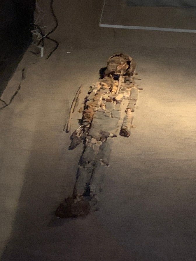
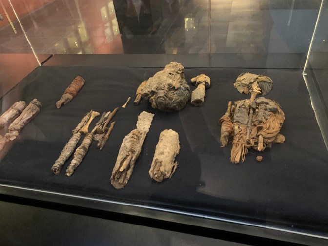
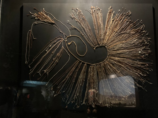
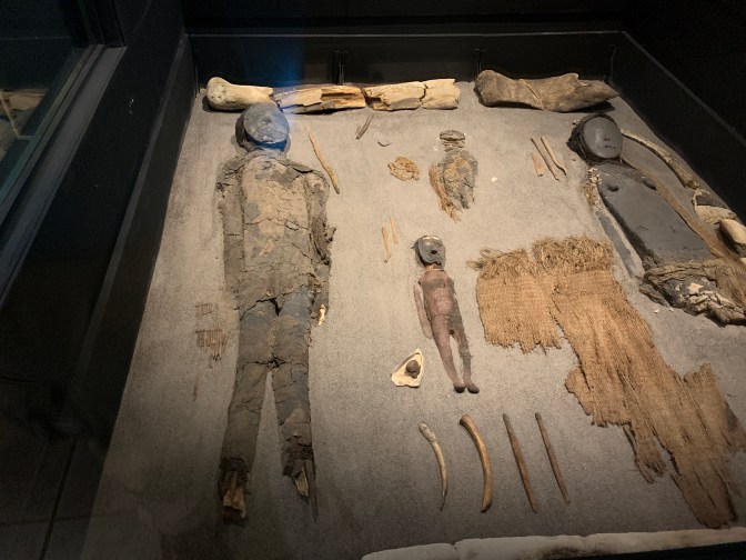
We reached our next destination – The archaeological museum of the University of Tarapaca – San Miguel de Azapa, 8 miles from Arica in the green Azapa valley. It is small, but is home to an important collection of pre-Hispanic culture. One building is dedicated to the Chinchorro culture (6000 – 2000 BCE / BC) and the other to different archaeological periods. Many ceramics / pottery, basket work, musical instruments, woodcarving and more are displayed, but our interest in visiting in particular was the collection of mummies over 5,000 years old of the Chinchorro culture that lived in thus part of modern Chile from 6000 to 2000 BCE / BC. The somewhat nomadic groups, but formed communities, were fishermen that supplemented their food with local vegetables and even Quinoa and land animals by trading. They typically ate their food raw and tended to live to an age of about 35 years. They believed that the dead would live forever with them and thus the mummification. Thus when they moved the mummies would move with them. Unlike Egyptian mummies, here all the internal organs were removed and replaced with vegetable fibers, straw, clay and covered with a red (Iron oxide) or black (Manganese Oxide) pigment. A black face mask would be placed over the face of the deceased.
These mummies were discovered by accident in 1983 and indeed continue to be discovered. Recently in the playground of one of the schools there was a mummy. Farmers or new construction run across them all the time, but if reported to the authorities, all other activity is stopped. Thus many just throw them out so as not to suffer months of work stoppage.
The culture that predominated on this coastal region prior to the Chinchorro were the Acha from about 11,000 BCE to 6,000 BCE. The Chichinchorro were followed by Quiliani (1000 BCE to 0), Faldas del Morro & Laucho (0 – 500 CE / AD), Gentilar San Miguel (1350 – 1470 CE) and finally Inka from 1450 – 1532 AD. The Europeans arrived in 1532 and by 1600 many of the locals were lost. In the highlands the Patapatane (7000 – 5500 BCE) were followed by the Hakenasa (5500 – 2500 BCE). Finally in the valleys the Alto Ramirez (0 – 500 CE), Maitas – Churubaya snd Tiwanaku (300 – 1000 CE) followed by the Gentilar San Miguel and Inka.
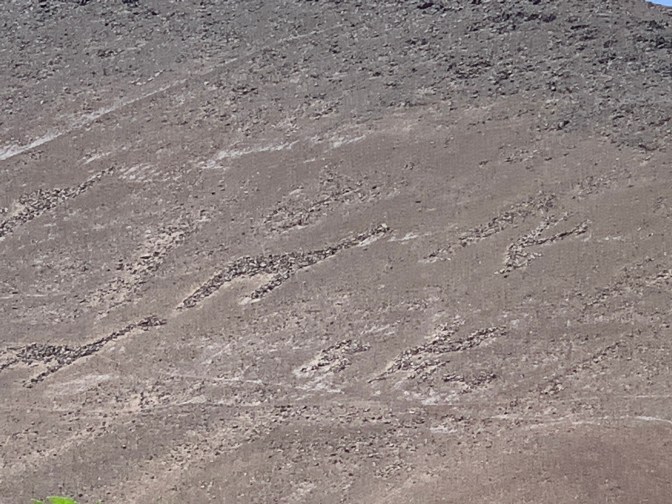
Exiting the museum we crossed the Azapa River and headed to another area in the Azapa valley where there are a number of Geo-Glyphs dating from AD 1000 CE. These are produced by placing stones on the sand forming patterns such as as Alpaca, llamas and people OR by scratching the surface bringing out the pattern with the substrate showing. These pastoral scenes along the mountains all are going in the direction of the Ocean. We thought this would be the highlight of the day, but it was very disappointing as only one group of 3 Llamas and a few anthropomorphic figures, could be made out on one mountain. Apparently there are others but not readily accessible. So after a few minutes there we were off to our next stop.

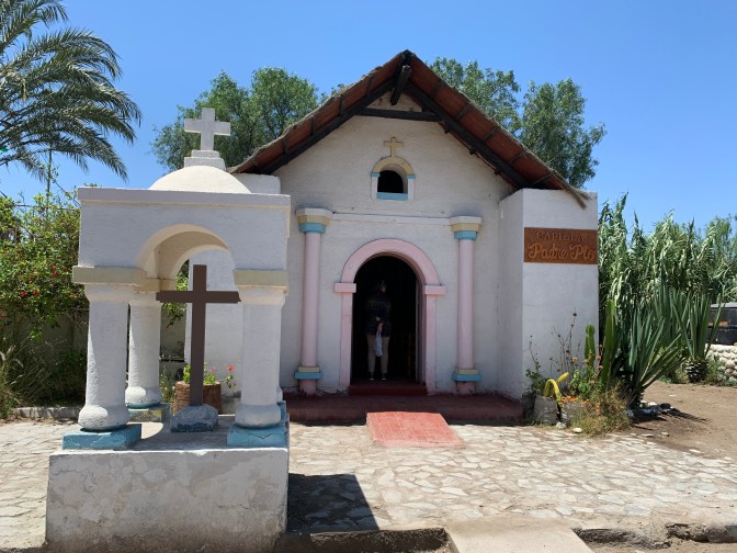
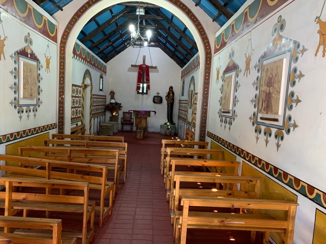
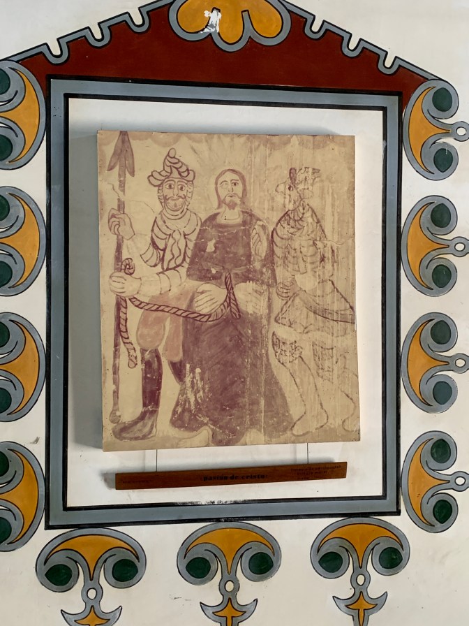
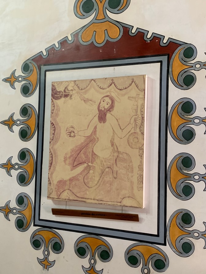
This stop at the Handicraft village was interesting as we arrived just as the local dance troupe, after performing the ancient Chinchorro dance – Banda de Sikuri – were dancing with other Cunard passengers. We then visited various workshops where the locals made different types of handicrafts on site in a life sized “mock up” village. Each “home” of the “village” has owner / operator handicraft manufacturing and selling, many related to clay : ceramics and Jewlrey. A small “Padre Pio” chapel had aboriginal drawings and attractive rustic decor. It is a replica of the 18th Century one in Parinacota, 200 kilometers from Arica at 4,360 meters (14,300 feet) above sea level in the Andes.
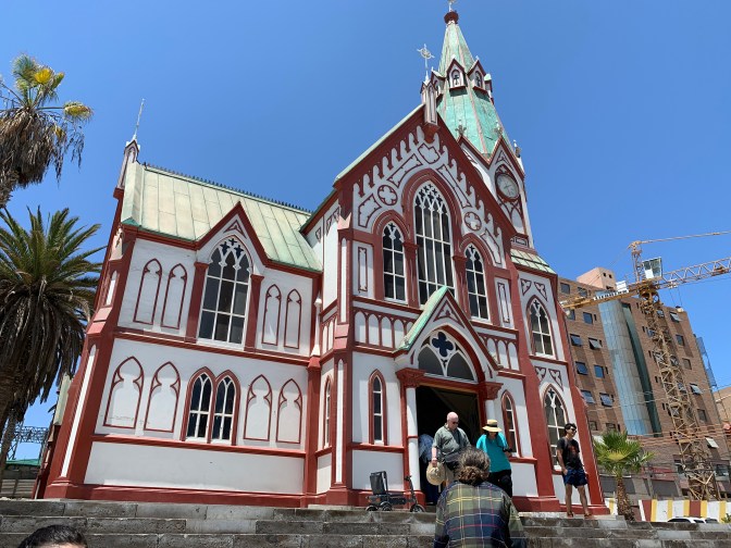
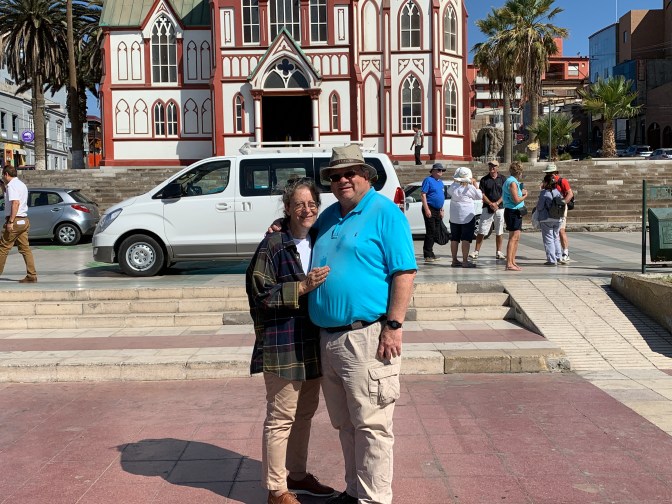
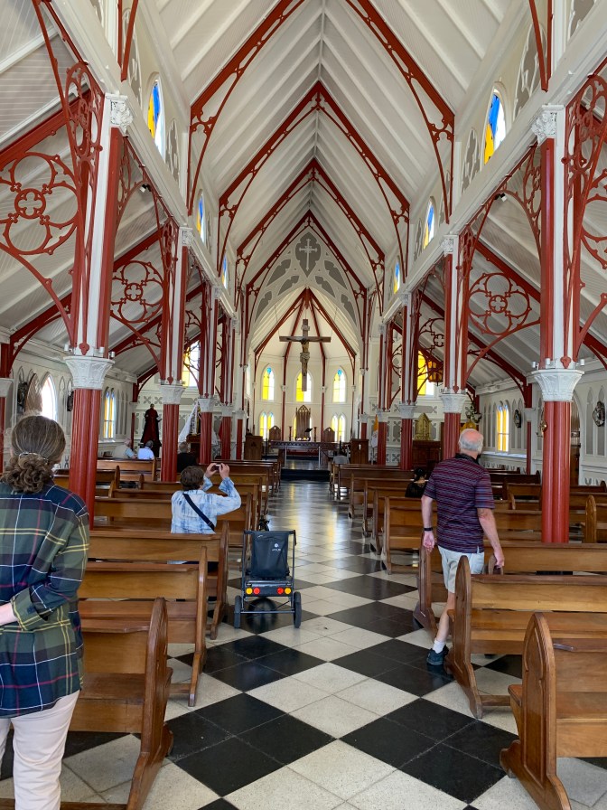
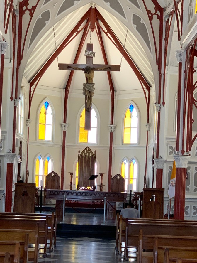
The final stop was at the main square and the Cathedral of San Marcos which was commissioned in the 19th Century when the city was part of Peru. It was originally intended for Ancón, north of Lima, Peru but was re- directed to Arica since it had just lost it’s cathedral to an earthquake. It was created in metal in the workshop of Gustav Eiffel and shipped from France to be assembled in Arica, where it has withstood many earthquakes. A small red and white structure with a single tower with green roof. The inside is modern with a hanging crucifix and a few statues. A side chapel has a small framed picture of the Virgin of Guadalupe from Mexico.

The driver and guide them returned to the Port, where we were to be left off. However, we had asked the driver if he knew of a good local restaurant away from the tourist area and he offered to take us. So we dropped the guide at the outside of the port and headed off. On the way we retained the services of the driver to lunch with us and then take us to see more of the city. He, a retired corrections officer with 30 years in the penal system, was happy to take us around. It was the first time he had ever branched out and done this on his own, mainly as he usually had English speaking guests and his English is poor to non-existent. As our entire tour was in Spanish, he was happy for the extra work.
He took us to Restaurrant Medina’s (Peruvian Restsurant) Av. España 2990, Arica, Chile +569-5305-8462 medinas.restaurantearica@gmail.com AND Av. Jorge Basadre Grohomann 550, Altria Av. Billingurst – Tacana, Peru (052)30-57-27 / 910368527. We enjoyed an eclectic dinner starting with Sea Urchine, slivers of raw tuna in a yellow spicy sauce and cold sea lion on lettuce with mayonnaise. The urchine was not a success and the three of us decided that it was not aesthetic with our palette. However the other two were very good. As a main course, Anne had Octopus on Quinua and the driver and I had a delicious steak over rice and beans.
All washed down with a Pisco red berry cocktail. Delicious meal.
He then drove us along the beaches, and we wandered the streets before it was time for him to drive us back to the ship. A full day.
We were both tired and full from lunch so we remained in the cabin, skipping dinner, the show and an early night.
On the list for next time would be – A) Drive through the Atacama Desert to Pampa Chaca – Juan Diaz Fleming created the Tutelar Sculptured Figures; B) Codpa village on River Vitor at 6,000 ft – The home of Cacique Altod de Arica C) Visiting the vineyard where the local Puntatani wine is produced as well as the Olive farm and seeing the extraction of olive oil; D) Liuta valley Cerro sombrero geoglyphs; E) Pukara de Copaquilla settlement pre-Inka F) Putre capital of Parinacota Region at 3,500 meters (11,500 ft) and interacting with the local Aymara people

I loved reading about your travels. Since receiving yours and Anne’s Christmas card I learned of this blog and in awe of your diligence in documenting your travels!
Can’t wait to see more when we’re past the lockdowns!
Michael & Heather
LikeLike