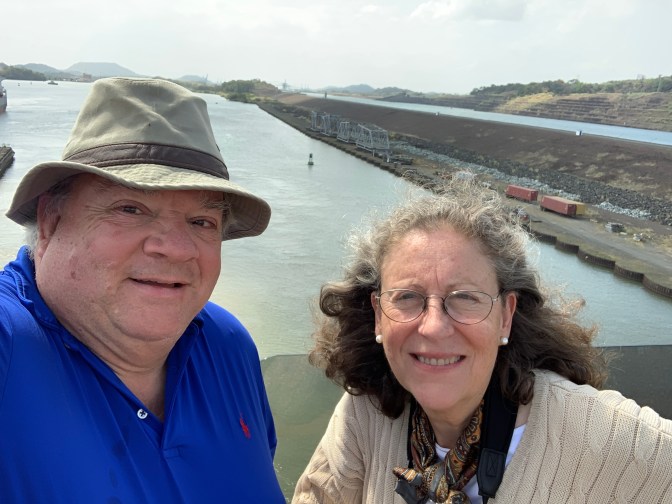
Wednesday March 11, 2020 – Transit Panama Canal, Panama from Pacific to Atlantic Oceans
I should at the outset dispel a couple of myths. Even though when one looks at a map of North / Central / South America one thinks of Canada in the North, Cape Horn in the South with the Atlantic Ocean on the East and Pacific to the West,
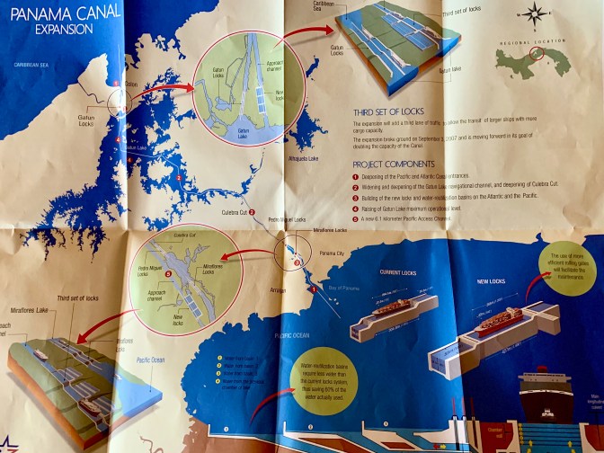
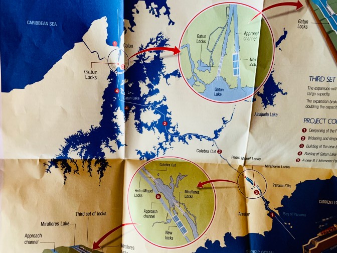
The Panama Canal because of the “S” shape of Panama, runs North – South with Colombia to it’s East and Costa Rica to it’s West. Ships entering from either side are lifted up 26 meters to Lake Gatún, by means of 2 sets of locks on the Pacific Side, in the old canal (one in the new), and one set of locks (both new and old) in the Atlantic Side. It takes most of the day to cross, the 50 miles (80 kilometers) but always an exciting hot and humid day.
The schedule for the day, which was basically kept, was to have the 2nd Pilot board the ship at 5:00AM. When you go through the Panama Canal it is the only place in the world where the captain completely and totally relinquishes control of the ship to the two pilots. There always have to be two highly skilled, dedicated and well compensated pilots. They are fully in charge of the ship, whereas in other ports, the pilots are there in an advisory capacity but the captain maintains control of the ship.
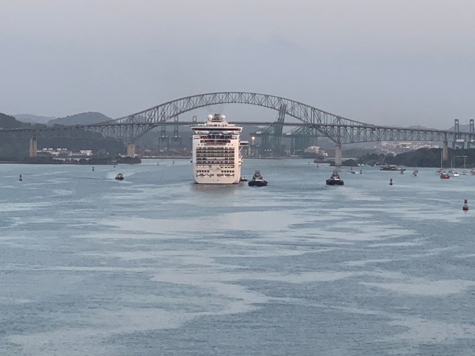
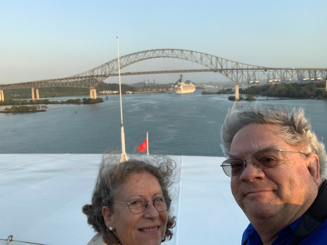
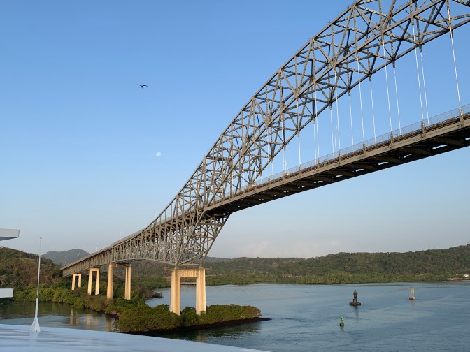
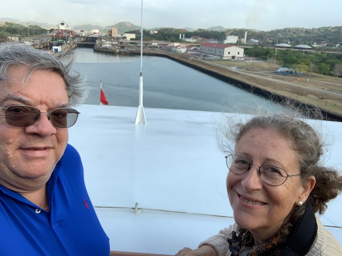
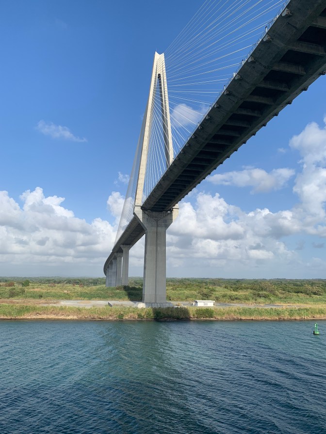
At 5:30 AM, when we awoke and went to the forward deck on floor 9 in front of the Gym, to watch the day’s happenings, we were already in the path going into the canal leading to the first bridge which was called The Bridge of the Americas. Travel speed was very slow in order to stay in the channel and so as not to bump into anything. Typically cruise ships take 8-10 hours to transit, whereas cargo ships typically take 24 hours. Soon after the bridge of the Americas, which apparently is soon to be demolished and replaced with a taller one, as cruise-ships can barely get under them, we were to go past the division between the “new” (opened in 2016) and the “old” canals. The Bridge of the Americas is 201 ft above Mean High Tide and 220 feet above Mean Low Tide. When it was built it was called the Thatcher Perry bridge, but it’s name was soon changed to Bridge of the Americas. It was built in 1962 with 3 car lanes, 2 lanes up on each side, then the two lanes merge in the center to 1 lane on the way down thus not safe!
There is often confusion as to “which is higher, the Atlantic or the Pacific?” and “why do we have to lift (or lower) the ship to get into the other ocean”?
Sea level is Sea Level irrespective of which ocean you are in as we saw in Cape Horn where we sailed from the Atlantic into the Pacific without being raised or lowered. However, there is an 18 foot tide on the Pacific, but barely 1-3 feet on the Atlantic, so it can appear that at times the Pacific is higher.
That being said, the next question about raising and lowering the ship. The issue here is that with the Gatún Dam blocking the outflow of the Chagres River, this caused the flooding of the hilly area, creating the Gatún lake which is 26 meters (85.3 feet) above sea level. This created not only a reservoir of water needed for the operation of the locks, but also a waterway for ships to travel across the land. So the locks at each end are there to raise ships entering from the Atlantic OR Pacific, to the height of Gatún lake 26 meters above sea level. Obviously to get back to sea level, one has to step down the 26 meters.
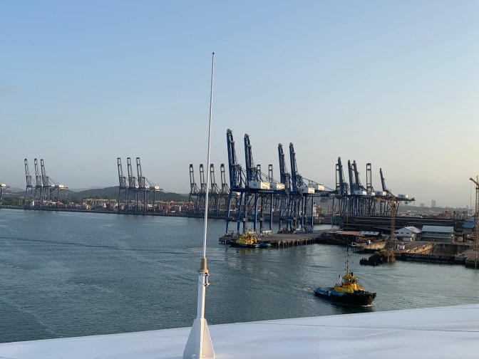
After going under the Bridge of the Americas, we encountered a series of very tall Gantry Cranes on either side.
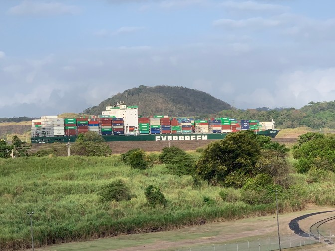
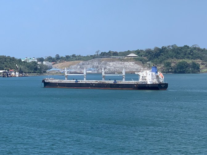
These are used to trans-ship containers from very large ships into smaller ones to travel through the canal. Behind the Cranes is Balboa on Starboard side which was a swampland, until a lot of material from the Culebra gap was placed there to create a place for buildings and the neighborhood. The Grey cranes are on the East side, and the Green cranes are on the West. The Pacific tug boat docking area was also there.
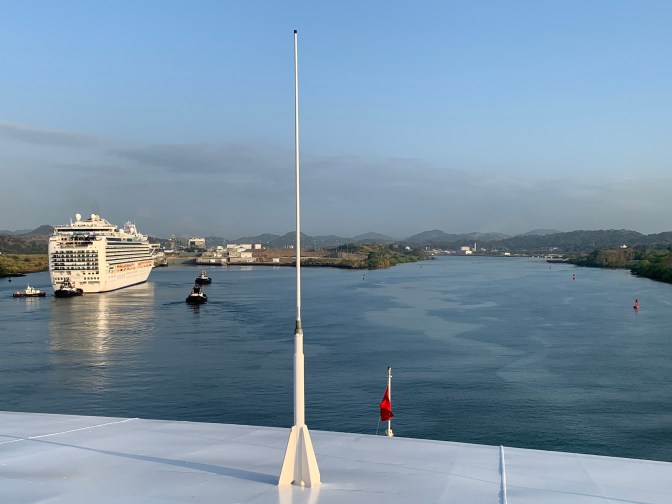
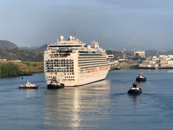
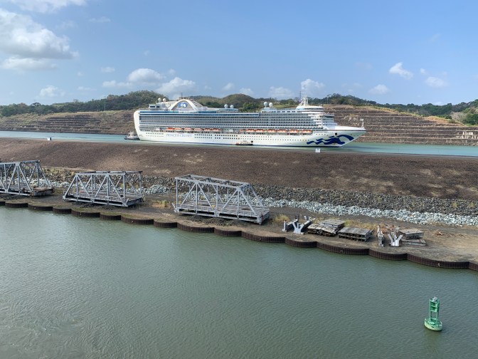
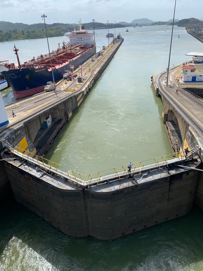
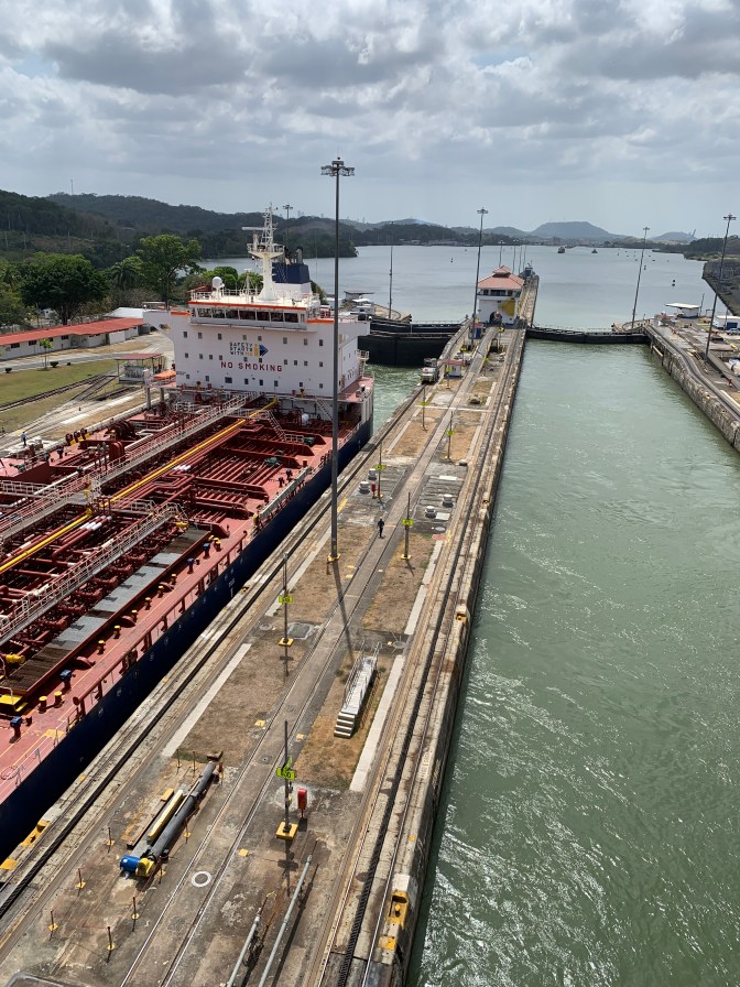
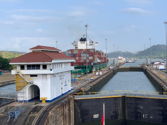
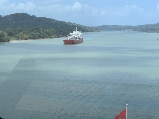
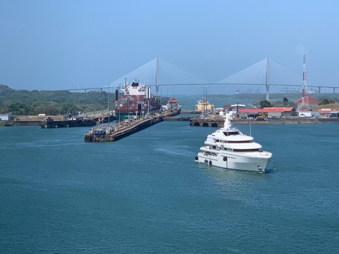
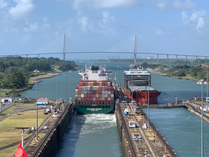
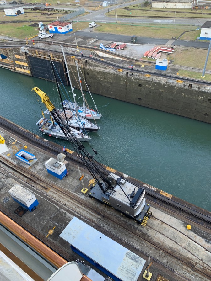
We were following a large Ship – The Emerald Princess, and when we came to a “Y” fork, the Princess went left (Port) into the New Canal lock and the Queen went right (Starboard) into the Old Canal Locks.
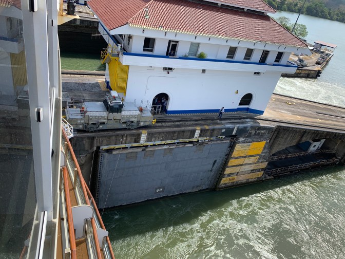
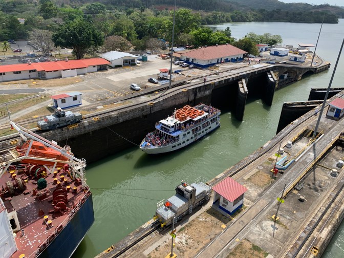
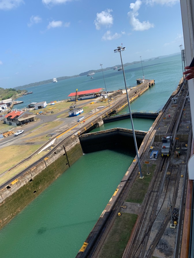
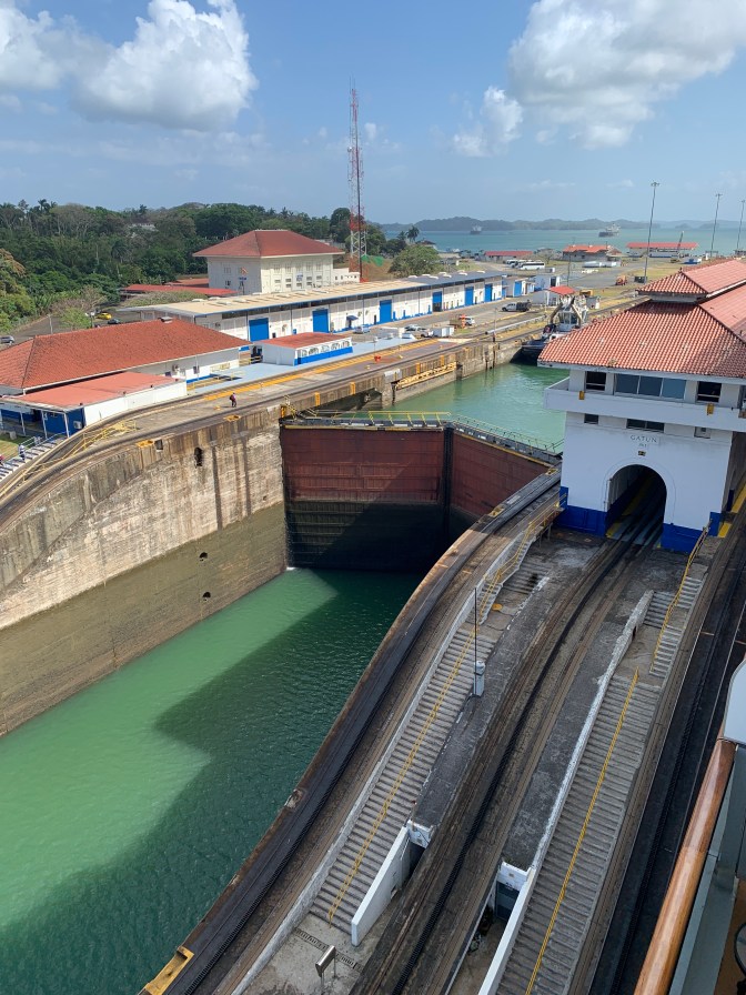
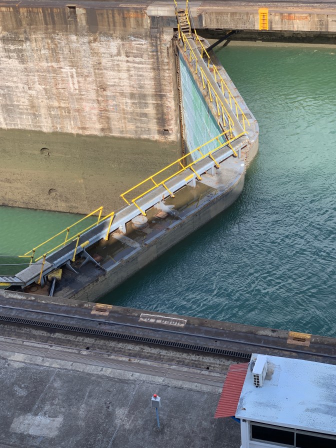
At 7:15 AM we Entered the first set – The Miraflores Locks. This is a group of two chambers, so as you enter, you go into one chamber of the lock that raised the ship half way, then you go into a second chamber which raised the ship to the level of Lake Miraflores which was made when the River was damed and a small 1 mile wide lake formed. Each set of locks of the old Canal can handle 2 ships at the same time irrespective of whether they are traveling South (Pacific) to North (Atlantic) or North to South. At 8:35 AM we Depart the Miraflores Locks and travel the relatively short distance to the next set of locks. The Largest sea or mitre gates in the system are the ones in the Miraflores locks due to large Pacific tide.
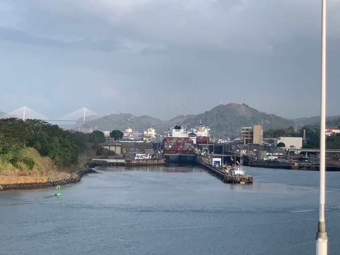
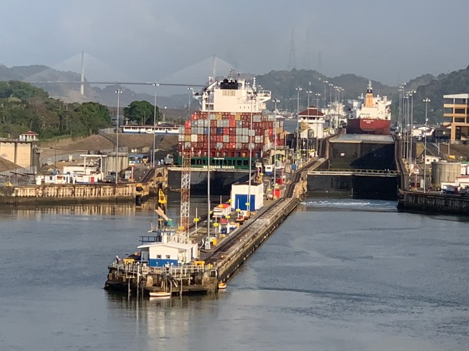
Ships going through the “New” canal – which meet up with the waterway we are on in the “old” Canal.
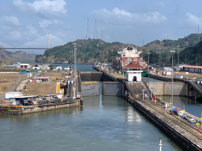
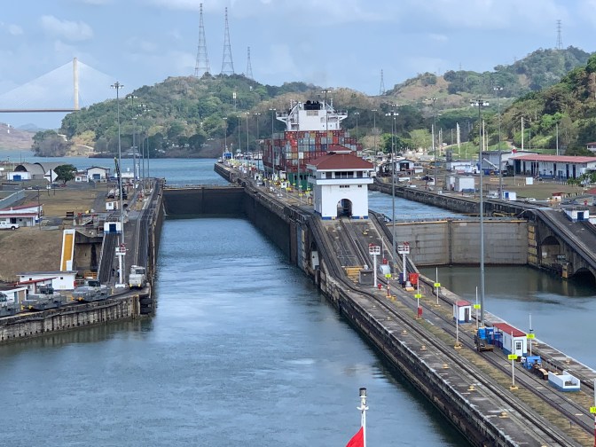
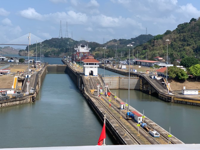
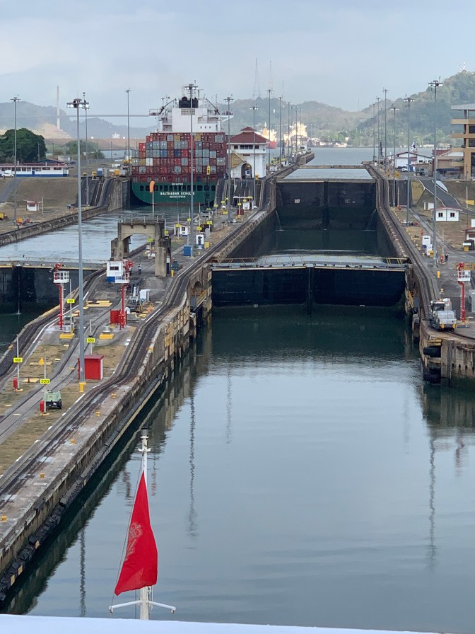
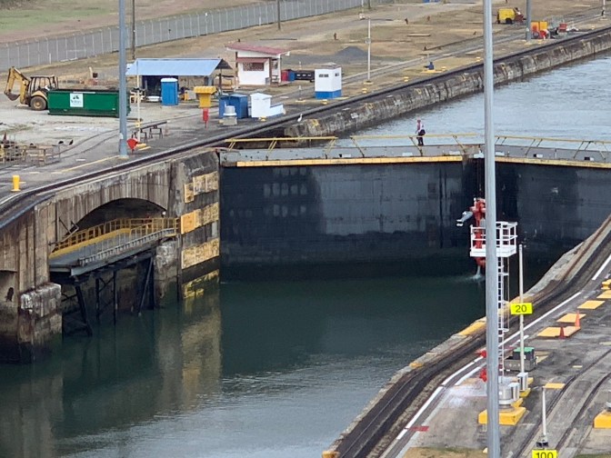
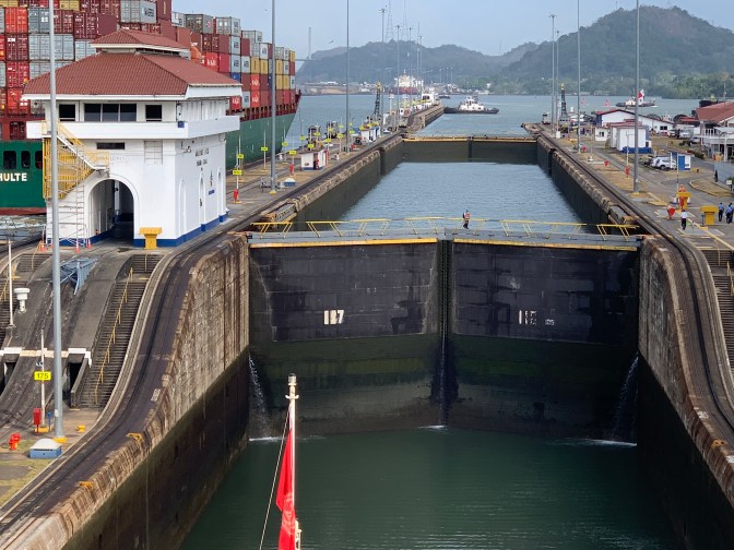
At 9:00 AM we enter the single chamber Pedro Miguel Locks, a smaller double set of locks that raises you to the level of Lake Gatún. Meanwhile the Princess only went through one lock getting to the same spot – another “Y” fork, where the new and old Canals meet up once again.
There is only one lock so ships have to travel sequentially, not at the same time. Earthquakes, tornados, hurricanes etc. are not an issue in the area, but the new locks are built to California earthquake standards made with reinforced concrete.
So at any particular time any three ships can go through the locks at the same time (1 in the new and 2 in the old). In the New locks 60% of water goes laterally between locks and only 40% gets lost, resulting in a 25% more efficient passage.
At 10:00 AM we Depart Pedro Miguel Locks now having lifted Queen Victoria 85 feet up to Gatún lake. We Travel under the 265 feet above mean high water Centennial Bridge, into the Gaillard or Culebra cut (the shape of the cut resembles a snake). This 12.7 kilometer Cut / waterway now, was extremely difficult to achieve. As one dug and filled the train at the bottom, much of the mountain collapsed covering the train. So a series of ledges was made on the sides and the shelf was used to have a train come in and get filled with rubble, taking it away to one of the various dumping sites. The amount of material excavated would build 63 Egyptian (Cheops) pyramids!
The Gaillard Cut has certain restrictions as it is very narrow so ships cannot pass, nor can they go at night. Many ships overnight in Lake Gatún. Balboa was NOT where workers lived as is often told. The workers lived much closer to where they were working.

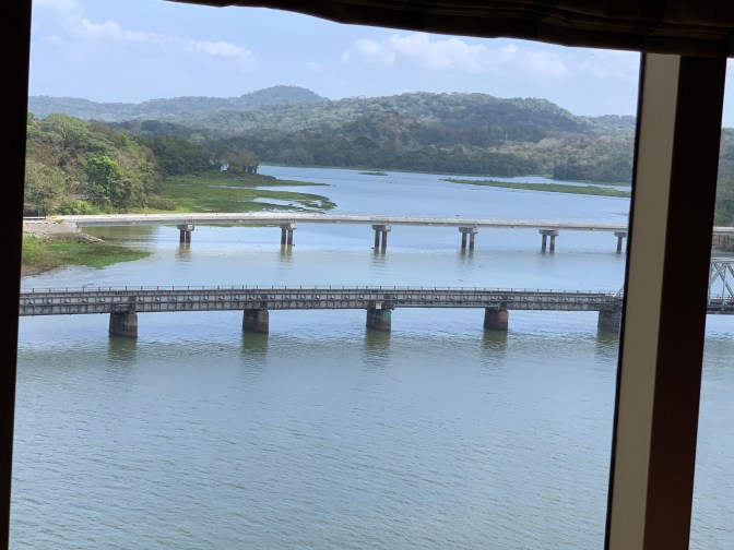
Soon thereafter we pass the Chagres River near Gamboa town and into the 12 mile stretch of Gatun Lake which takes about 2 hours. Lake Gatun is 164 Sq Miles 42,500 hectares.
The railway between Colón and Panama City passes over this river and in times of high water, it nearly reaches the railway line. The lecturer Richard lived in this central Continental Divide, where it rains 9 months a year, and stated that in the rainy season 12 feet of rain could fall in a day. When he was living here, all Canal personnel had company housing and they had metal roofs, so during a heavy rainstorm, one could not hear oneself think, if you were outside (or sometimes inside) you would get soaked and muddy trails would result.
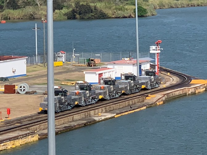
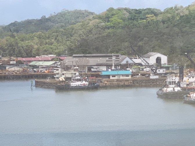
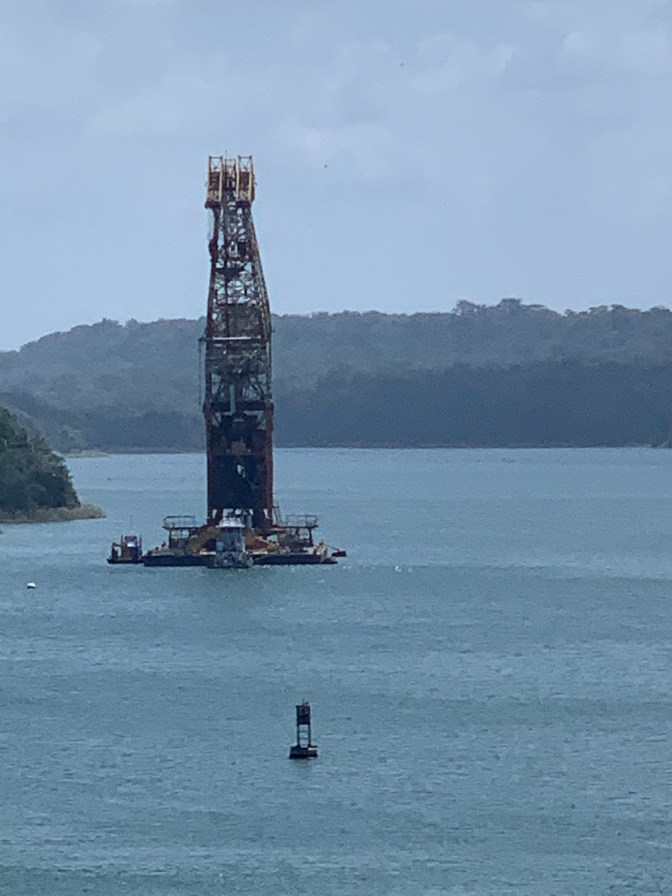
We went past “Herman the German”, giant crane that helps in all aspects of Canal maintenance. Drill boats constantly dredge and special ships take the rubble to dump in one of the locations.
We continued our gradual course through Gatún lake and reached the triple chamber Gatún locks at 2:05 PM. These are much slower so it wasn’t until 4:30 PM that we departed the Gatun Locks. The Gatún are the biggest set – 3 chambers in each lane on the Atlantic Side, as at the time of building it was considered that they had to split it into three because the ground was not strong enough to support 2 chamber sets. In later studies it was shown that it could have been done with 2 chambers.
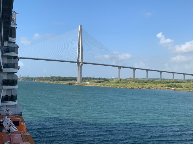
From there we went under “The Bridge to Nowhere” as it is called as it crosses the canal on the Atlantic side but on the West side it leads into a jungle. We then entered the Limón Bay where the city of Colón (much smaller than Panama City) is located and into the Atlantic Ocean / Carribean Sea.
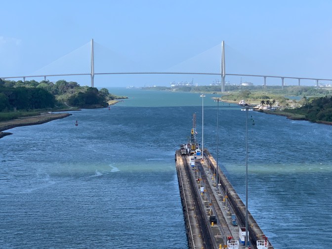
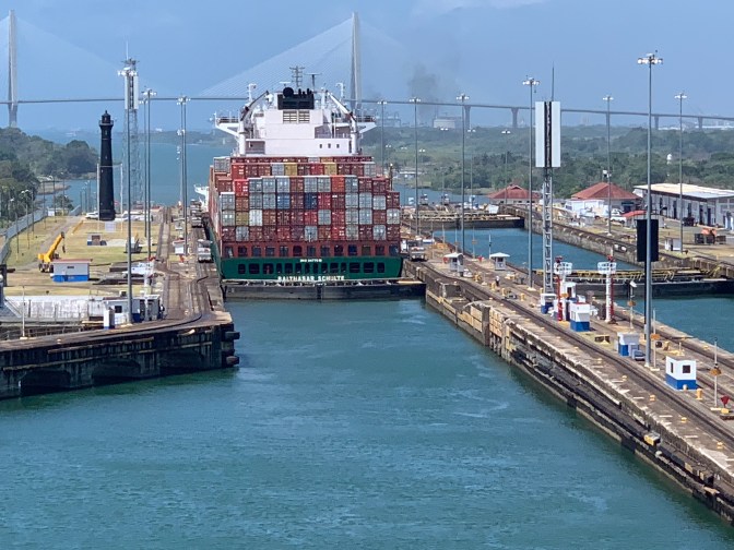
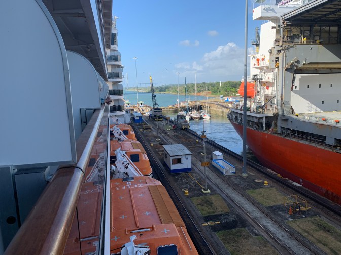
The Emerald Princess going through the “New” Atlantic Ocean Canal and below, the “Y” where the “New” and the “Old” Canals meet on the Atlantic Ocean Side
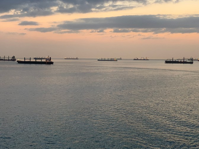
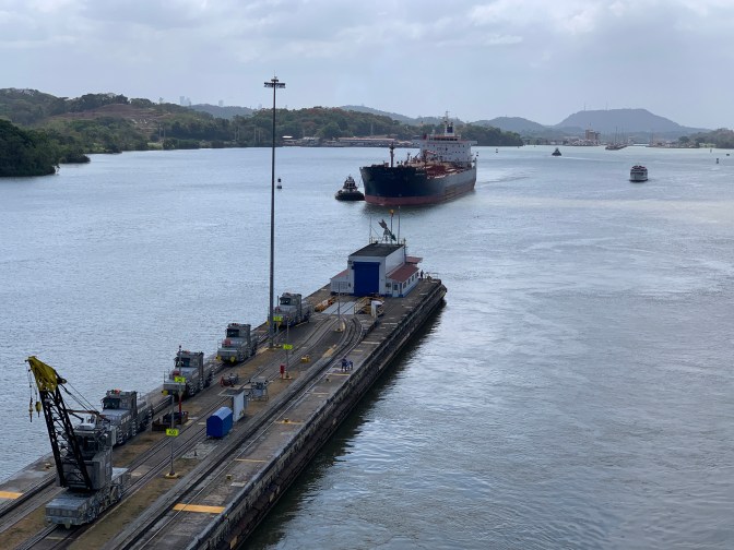
The system today allows for 35 locks per a day a self imposed, current limit as there is a bit of a drought. Under normal operations, there are 35-40 Locks a day for the old Canal and up to 20 a day in the new canal. The New locks use a smaller amount of water lost even though they are larger as there is a more efficient way to use the water. If a ship is small you can do tandem locking – when 2 or more ships go through at the same time thus transits may be higher than lockages. We observed three private sailing vessels and a grain carrier entering the same Gatún locks from the Atlantic as we were exiting.
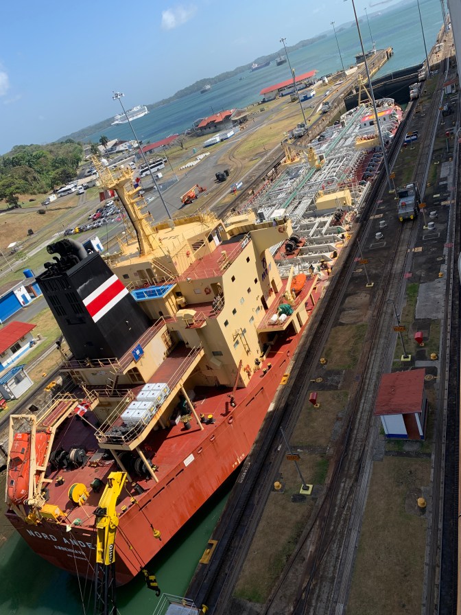
The Canal Dimensions are:- Locks are 1000 ft (304.8 meters) long and 110 ft (33.5 meters) wide, 80 feet deep (Panamax or the largest acceptable ships that can transit are – 965 feet (294.1 Meters) long by 106 feet (32.3 meters) wide.
The New locks are 1,400 feet (427 meters) long and 180 feet (55 meters) wide with the New Panamax being 1,200 feet (366 m) long by 160 feet (49 meters) wide.
For comparison purposes, the Queen Victoria is 294 meters (965 Feet) long, 105 ft wide, 63 meters (207 Feet) high Keel to top of funnel with a draft of 8 meters (26 feet) so 55 meters (180.5 feet) above the sea level. The captain indicated that we had 18 inches on either side of the ship going through the locks.
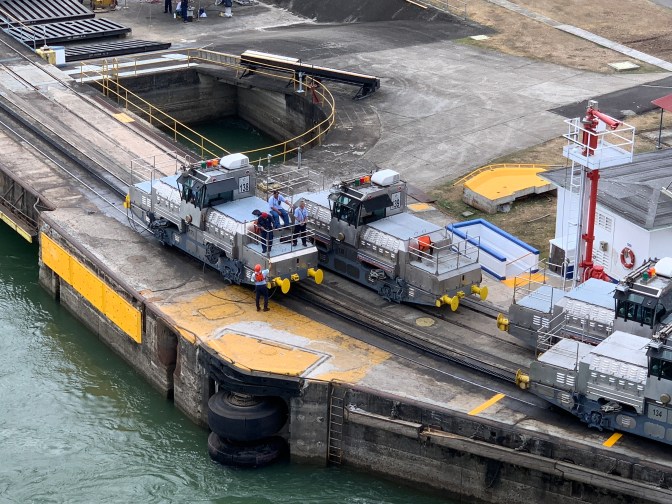
The reason for the numbers on the new locks being what they are, is that the new locks are operated by tug boats whereas the old locks by the ships own power using the trains to steady the position.
Initially, ships would be taken into the Canal as they arrived, but with the ever increase volume, a booking / Transit schedule was developed. This was soon implemented after a meeting of Richard (our on-board commentator) with the CEO of Maesrk in Copenhagen who wanted to get oil through quickly and sometimes his ships had to wait a few days. He wanted to have a guarantee that on every Friday he could pass his ships through the canal first. He took out his check book and said “How big a check do I have to write to have that Guarantee”? Richard said it does not work that way, but realized that some form of scheduling was critical. Today they schedule all but one or two slots per day as if a ship arrives without a schedule they get put in those slots at a hefty surcharge. On September 10, 2010 the 1 millionth transit of the Canal was made by the Bulk carrier Fortune Plumb.
Perhaps this is the time to talk about the costs of transiting the Panama Canal. When the Americans were operating the Canal, the Fee schedule was fixed and indeed it was run as a not for profit efficient company. Today the Panamanians have a much more complex system. Our tour guide onshore indicated that for cruise ships it is US$100 per empty cabin and US$260 for a cabin with passengers, irrespective how many. The most expensive fee paid for a transit was by a Norwegian ship that had 94 ships ahead of it, but they needed a “fast track” so they paid US$2.5 million! On average they take Un US$7.5 million a day.
The Queen Victoria paid about $300,000 – $350,000 to transit. The largest cruise liner to transit (with reservation) was the Norwegian Bliss that pays fees of $900,000. The Large container ships pay about $1MM fees. A formula based on gross tonnage, displacement etc is used for commercial cargo carriers. There is a fee for transiting plus additional fees for tugs, pilots, a water and energy surcharge etc. The Panamanian and Colombian military vessels are the only ones that get discounts.
Thus the Panama Canal Authority, a separate government autonomous organization, collected some US$2.6 billion tolls last year. The least amount ever paid to transit was $0.35 by a US swimmer – Richard Halliburton who swam the canal in 1928. All the costs and revenue are openly available. While this seems like a lot of money, and it is, the maintenance, continuous dredging efforts, repairs etc plus staffing result in high expenses. There are 261 pilots – we need 2 pilots, 10,000 employees, 106 locomotives now made by Mitsubishi at $500K each, (the original ones were made by General Electric at $18,000 per locomotive$, 46 modern tug boats and general maintenance costs of US$500 million a year, etc. Given the notoriety of the shipping industry when it comes to paying their bills, all tolls have to be fully paid at least 2 days in advance, otherwise you don’t get into the queue. Cruise ships always have priority. In the morning the Pacific locks are one way to Gatun Lake, later they go the other way with ships passing in Gatun lake. A similar situation exists on the Atlantic side.
As far as water management, 26 million gallons are used per lockage irrespective of the size or number of ships in the lock chamber. This is because they need to be raised the same height irrespective of size. Thus one uses 26 million gallons at the Pacific locks and the same at the Atlantic side resulting in 52 million gallons of fresh water getting dumped into the ocean per ship. The water comes under the keel of the vessel via 70 rising step valves per lock and raises the ship gradually 26 meters. There are 46 double gates in system. In some places there are a double set of gates for safety and can be used for small boats and if you need to repair one of them.
Having crossed the Canal it is perhaps prudent to discuss a bit of History and how we were able to have such a terrific and enlightening day.
We were very lucky, thanks to Cunard to have Richard Wainio on board ship not only before and after but during the transit of the Panama Canal today. I say we were lucky as he is probably one of the worlds leading expert on the Panama Canal. His father and grandfather were involved with the Canal since it’s building by the Americans. All three working on it in various capacities and he and his father eventually to managing the whole canal operations. Richard grew up in the Canal Zone and as his father managed various different positions the family moved from the Atlantic side to the Pacific side it to the center and back again.
So let’s start at the beginning 1513 when the Spanish Explorer – Vasco Nuñez de Balboa became The first European to discover that the isthmus of Panama was just a slim land bridge separating the Atlantic and Pacific oceans. Balboa’s discovery sparked a search for a natural waterway linking the two oceans.
In 1530 the Camino Real and Las Cruces Trail was built so by 1533 a land based transit allowed Peruvian Gold and Silver to be transported to the Atlantic so as to get to Spain.
In 1534 realizing that no water passage across the Isthmus had been found, Charles V, The holy Roman Emperor ordered a survey to determine if one could be built, but the surveyors eventually decided that the construction of a ship canal was impossible.
We now jump to 1811 when the first authoritative study was done by Alexander Von Humboldt who determined that Panama was not the way to go, but it could be done through Nicaragua.
In 1848 with the rise of the California Gold Rush and the need for people and supplies to get from East to West, a Panama railroad between the ocean s was started in 1850. It was completed in 1855 at a cost of US$8 million and an estimated 12,000 workers died during the construction. However, it only went 8 miles across, and the people had to walk the rest of the way. It was a successful venture financially so it eventually was finished, and sparked a new interest in a waterway.
In 1869 the transcontinental railway across the USA was completed and the Suez Canal opened creating more interest in a Panama Canal. A US survey between 1870 and 1875 concluded Nicaragua would be a better alternative and Panama would be more difficult. However, it was the French in 1878 that signed a contract with Colombia (Panama was part of Colombia) to build a canal through Panama. The famous French Architect Ferdinand de Lesseps was commissioned to build the canal.
He insisted on a Sea Level Canal, like Suez, despite recommendations from Engineers that a lock type canal was better. So he raised, in 3 days, US$240 million in investments, selling shares in the new entity, and work started in 1881. In 1887, the sea level canal was abandoned and the shift to high lake with locks was started. By 1889, some 20,000 workers had died from the insect born diseases and he declares bankruptcy, with all investors loosing their money. He disappears in disgrace having only visited Panama once. It failed for various reasons – inadequate technology, decision to build sea level, lack of knowledge of source of yellow fever or malaria, underestimating the elements, all this despite having some of the best engineers in the world. The death toll was ghastly. 2-3 out of 4 Frenchmen died, 33 Italians arrived with only 6 alive after 3 weeks; 40 French Engineers arrived of which 13 were dead in the first month, mortality rate at the hospital was 3 out of every 4 that entered the hospital died; so a Funeral train ran daily and sometimes more frequently, taking the dead to the graveyard.
In 1899 the US become involved recommending Nicaragua, but President Teddy Roosevelt decided on Panama and negotiated an agreement with Colombia. This was approved by the Senate in June 1902 (by being pushed by Engineer Philippe Bunau-Varilla, that the Nicaragua option was subject to earthquakes). However Colombia Senate in August 1903, rejects treaty. The US buys French Assets for US$40 million.
On November 3, 1903, with the “Strong-arm” of the US, Panama declares independence from Colombia and 15 days later signs the Treaty giving the US the right to build the canal. This treaty gave the US the rights, in perpetuity to the Canal, as if Sovereign. US paid Panama US$10MM and agrees to pay Panama a fee of $250,000 a year. The US is given the right to intervene unilaterally in Panama as part of a guarantee to keep Panama independent.
John Wallace arrives to head up the project, but resigns a year later with slow progress and yellow fever deaths. He is replaced in July 1905 by John Stevens who insists on better equipment, sanitation and trains to haul the dirt and stone. Chief Sanitary officer William Gorgas deployed 4,000 men to sanitize the area, killing larvae of the mosquito. The first recorded death by yellow fever was on July 10, 1904 and the last (Number 246) died on November 22, 1905 achieving great success in the elimination of disease.
Despite the recommendations of a Sea a Level Canal, the US Senate approves by 36-31 a lock type canal.
In 1907 Stephens resigns and replaced by Lt. Col George W. Goethals and by December 1907 the workforce reached 46,000.
In 1908 decision was made to enlarge the locks from 95 feet wide to 110 feet to accommodate the largest battleship. (The Titanic was 94 feet and the USS Pennsylvania was 98 feet wide).
The first concrete was poured at the locks in August 1909 and by May 1913 the last locks at Gatun were completed. The Gatun Dam was completed in June 2013 creating the largest man made lake (at the time) – Gatun Lake. The Chagres River flows from our Starboard side and empties out into the Atlantic near the town of Colón. However, this was Damed creating the Gatún lake.
The Culebra or Gaillard Cut which was the main channel with millions of tons and rocks removed was opened in December 1913. Thus the 200 million cubic meters (262 Cubic Yards) of rubble that was removed was used to create Balboa from a swampland, connect islands and a number of other land reclaiming. If all this material were to be put on railroad flatcars, it would circle the globe 4 times!
The first unofficial transit of the Canal was August 3, 1914, so it should have been front-page news given the enormity of the engineering effort. However it was the day that Great Britain declared war on Germany, starting the First World War. So news of the Panama Canal opening was relegated to a small column on an inside page of the main newspapers.
The official opening August 15, 1914 with the transit of the SS Ancon.
Electricity really moves the canal with GE manufacturing all the electric trains that used to pull ships through at a cost of US$18,000 each. Today these have been replaced by Mitsubishi made ones at $500,000 each and they are only used to keep ships in place as each ship transits under it’s own steam. There are 1500 electric motors that ran the canal locks. An electric motor opens and closes each of the 92 “miter” gates and 46 more miter forcing motors. These are the “doors that swing open to allow ships to go through and then close in a “V” shape to fill the locks with water with the sharp part of the “V” facing the water side. There are 100 rising stem valve motors.
In 1936 the US – Panama Treaty amended to remove intervention rights but retained the 5 miles on each side sovereignty of the Canal area.
In July 1940 work began on new locks to be 1200 feet long by 140 feet wide to accommodate the new US battleships, but this was suspended in May 1942 when the ships were cancelled. However that work is the basis of what is the “new” Canal. In 1963 (May 12) 24 hour operations started and continue today 24/7/365.
In 1964 after riots and anti-yankee feeling, a new treaty was proposed and rejected by Panama. By 1971 a new treaty became critical and in 1974 Kissinger and Tack sign an “Agreement of Principles”. In November 1975 Carter was elected president and in 1977 he and Omar Torijos sign a Panama Canal and Neutrality Treaties, In October 1977 Panama approves and April 1978 US Approves treaties, but it was very unpopular and may be part of the reason why Carter was not ready-elected. After much arm-twisting, the Senate only approved the treaty by 1 vote! The Treaty was implemented in October 1979 in which the canal and all buildings, land and 14 military bases were given to Panama. A 20-year “training period” in which the transition was to take place, so the canal was formally handed over in December 31, 1999.
As of January 1, 2000, the Panamanians have had full control and operate the Canal basically to the same standards as when under US rule. With container, oil and gas ships ever larger, there was a need to expand the size of ships that can transit through the canal. The Panamanians, using some of the work done by the US in the 1940’s completed the “new” Canal and it was opened in 2018. I say “New” Canal, it actually is a new (Agua Clara) Lock Chanel that “by-passes” the Gatun Locks on the Atlantic side and combines the change in height that the Miraflores and Pedro Miguel locks achieve on the Pacific side with one (Cocoli) larger lock and a 6.1 Kilometer Channel. The rest of the 50 kilometer transit is the same irrespective of which set of locks that are used by the vessels. The new locks have a different design. They each have try here chambers, water-saving basins, a lateral filling tank and emptying system and rolling gates.
The canal had a little impact on global trade but it did put the last nail in the coffin of the sailing vessels going around Cape Horn. It did though, foster the development of the west coast of South America and helped the US take marketshare from the Europeans. The primary impact was to end the dominance / monopoly of rail as the means of to move goods across the USA. Ships could easily go from East Coast US ports to West Coast Ports and Vice versa, through the Panama Canal.
Use of the canal ebbed and flowed during the depression and WW-II, but the big push was the container revolution which started April 26, 1956 with the SS Ideal-X – 524 ft long carrying 58 containers. Modern large container ship carry up to 14,000 containers (eg MV Emma Marsek is 1320 ft long with a capacity of 13,800 containers).
