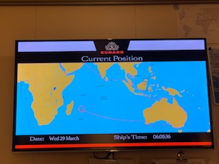
Wednesday March 29, 2023
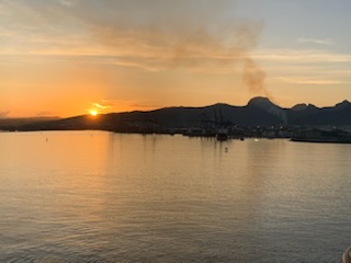
We docked early this morning starboard to dock as we did a 180 turn just outside the harbor then backed up for 1/2 hour in a narrow passage that is the harbor, past various container and other cargo ships until we slid in just behind another commercial vessel but only some 10 feet away. Great maneuvering by the captain. The dock is commercial and there are absolutely no facilities of any kind. A couple of tents were put up to shade the authorities, but no vendors or buildings. We walked over the quay to small 15 passenger coaches and boarded, left hand drive, with a young man, Gregory as our guide. He admitted at the end that we were his very first group coming off a ship that he had guided as he is still in school. Although he was not very good as we travelled around and telling us when to be back on the coach etc, he was brilliant at the Botanical Gardens which was our third stop. The first and second were a colonial home and a fort, and after the garden we went to a sugar factory, a shopping mall and a red church.
So let’s start with a bit about Mauritius, officially Independent it is called “The Republic of Mauritius” “République de Maurice” in French and “Repiblik Morai” in local creole. It is an island nation that is 900 miles east of Madagascar or 2,000 miles off the coast of east Africa in the Indian Ocean. It’s closest large island is the French “Owned” Island of Reunion some 125 nautical miles away. The main island where the majority of the 1.2 / 1.4 Million people live is Port Louis, the capital but it actually consists of 49 islands, some of the other larger ones are – Cargados Carajos, Rodrigues, and Agalega. The main island is 65 km long X 45 km wide and covers in total 790 square miles (2,040 square kilometers) with 155 kilometers of beaches. Even though the “Official Language” is English, it is only spoken by about 1% of the population. The main language is Mauritius Creoles which is a French based creole as well as French which together are the languages of over 90% of the population. The largest ethnic group is Indian 87%, thus Hinduism is the religion of 50% of the people, 35% are Christian and under 20% are followers of Islam. The reason for the large Indian population is that after slavery was abolished, many indentured servants were brought in from southern India. The island was formed some 8 million years ago by volcanic activity. Arab sailors were probably the first to discover the uninhabited island around 975 AD calling it Dina Arobi. In 1507 Portuguese sailors arrived on the island and called it Carney or Do-Cerne, but did not stay. The Dutch in 1598 did take over the island establishing a few settlements, calling it in honor of Prince Maurice of Nassau, the Stadtholder of the Netherlands, but abandoned it by 1710. In 1715, France was the colonial power calling it Isles de France. However in 1810 the British took over the island as the colonial power and in 1814 at the Treaty of Paris, the French ceded the island to the British. However the French residents remained. The British remained and established the school, parliamentary and driving side etc until the Island gained independence on 12th March 1968 when the constitution was formed and then it formally became a Republic on 12th March 1992. Of interest it is the only place where the Dodo bird existed and was made extinct due to human activity by the late 1600’s.
A few facts and figures we heard: – It has a lot of French Colonial Architecture, the highest point is 2,000 ft above sea level (828 meters); It is the 20th most densely populated island in the world; the Mauritius Rupee is the currency; Robert Farquat, the British Governor brought in tea as a crop to the island but it went into disrepair after his departure until Sir John Pope Hennessy brought back tea as a key crop which it remains today – Black Vanilla Bois Cherie Tea; there are many sugar cane plantations producing both sugar as well as rum which we enjoyed tasting both; it has the moniker “Delicious Mauritius” given it’s blend of British, Malaysias, Asian, Chinese mixture; the textile Industry – Made in Mauritius label – shows good clothing; Some of the good things to buy apart from rum, sugar, tea and clothes are wooden ships – Bounty, Cutty Sark, Endeavor are the most popular. There is a Fort Adelaide affording a panoramic view, built in 1835 and 140 ft above sea level; The Blue museum has the rarest stamps in the world worth US$2.5 million each – the red & blue penny stamps. The horse racing takes place between May and September track and there is a Casella World of Adventure park 4,500 acre animal reserve.

The tour we took was the “Northern Discovery Tour” taking us to a 1830 stately home, the Citadel, the Pamplemousses or SSR Botanical Garden established in 1767 by Pierre Poivre with it’s peaceful pond giant waterlily and la venture sugar world.
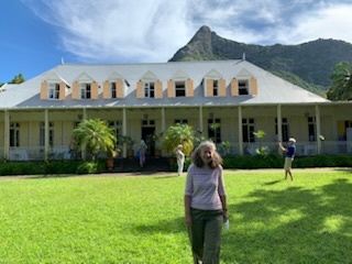
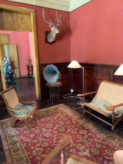
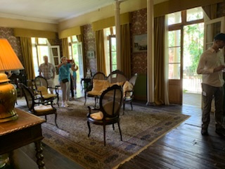
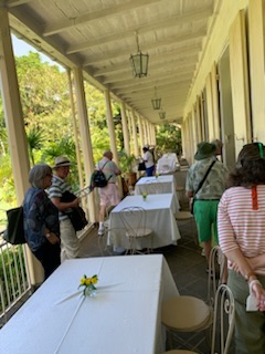
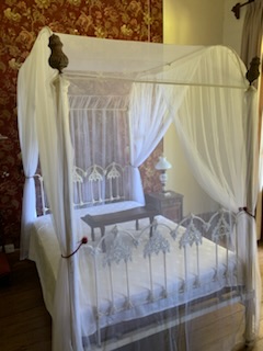
As mentioned, our first stop was at Eureka – an old colonial home, now a museum, where there were various rooms with period pieces, a nice outside area and garden with a nice view of the canyon. However, there was little explanation as to anything about the origin or why we were there or indeed the importance of the place. It was nice, but we are sure has a lot of interesting history. They did provide us with a bottle of water or soda and a small plate with 5 items of finger food, which we assumed were typical of the area. All very nice, but a shame we didn’t have more of an explanation.
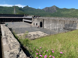
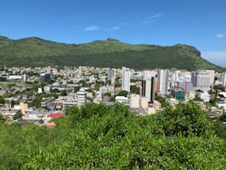
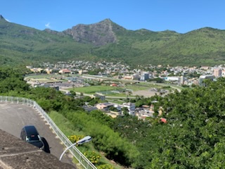
Back on the coach we drove to another part of town where we were dropped at the door of Fort Adelaide / Citadel, again with no explanation, but after climbing the ramparts, we got a spectacular view of the city and the horse racing track. According to some of the signs, it was built between 1834 and 1840 on the “Petit Montagne” facing the Port Louis Bay. Part of the structure, built by the French in 1743 was incorporated into the Fort. It was named after Queen Adelaide (wife of King William VI). It measures 150 X 100 meters and can accommodate 200 soldiers with a stock of food lasting 3 months, 40,000 gallons of water and 280 barrels of gunpowder.

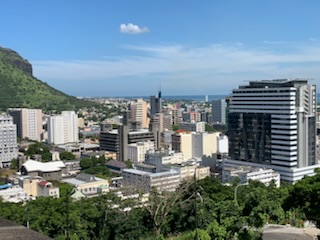
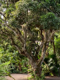
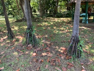
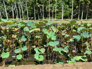
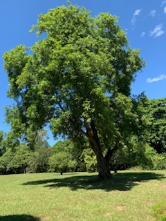
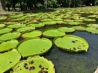
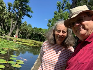
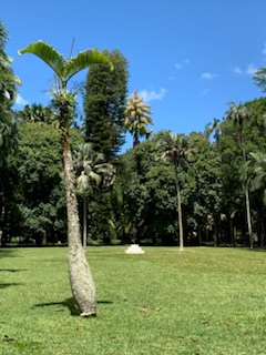
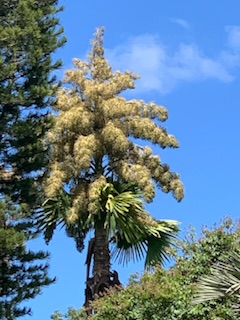
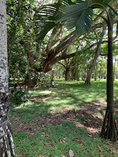
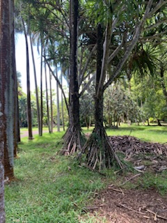
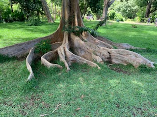
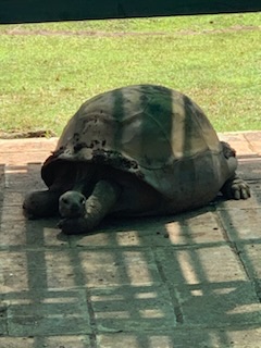
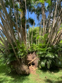
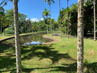
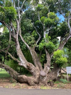
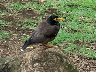
We then continued our drive through the city past the parliament with statue of Queen Victoria, the Bank of Reunion which is the tallest building on the island and past many other buildings, through Chinatown and out of the central part of the city. We headed to the SSR (after the PM Sir Seewoosagur Ramgoolam) Botanic Garden Pamplemousses. It’s origins date to 1736 when there was experimentation as to what plants would grow in the region. In 1767 Pierre Poivre, purchased the property who initially focused on spices such as nutmeg and cloves. By 1785 it consisted of 600 plant species. It was then known as the King’s garden and It was here that the guide really came into his own and shined. He talked about each of the trees, the different palms – walking palm with roots coming out as if legs, the elephant palm, the millionaire palm that is eaten etc as well as all the other trees. In one area there were some animals – giant Tortoises, Deer and others. Perhaps the most impressive part was the floating Giant Water Lilly (Victoria Amazonia) pond. It was introduced into this garden in 1927 and was “discovered” in 1801 by the German Botanist Thaddeus Haeckel and named in honor of Queen Victoria. We saw these a couple of years ago deep in the Amazon Jungle in Manaus (3 days by ship along the Amazon from the Atlantic Ocean). They are truly amazing and consist of a flat leaves floating on the surface with vertical rims that can get to 20+ centimeters high all around the edge of the circular plant. They can reach a diameter of 3 meters (9-10 feet). The night blooming flowers are initially white turning to violet the next day. On the third day the flower sinks to develop a seed capsule that can contain up to 300 seeds. They develop spines on the bottom to protect against predators. This pond is about 100 meters (yards) long and 30 meters (yards) wide and covered the full length with these amazing aquatic plants. The optimal temperature is between 25C and 32C for growth. We really enjoyed the Gardens, and managed to see quite a lot of the park.


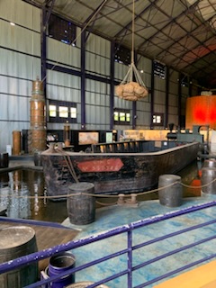
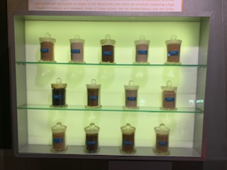
Our next stop was the “Sugar Adventure”. This is an old sugar mill, now converted into a museum but all the old equipment has been left. It not only talks about the era when sugar was the dominant crop, and still today there are sugar mills and sugar is an export, but it also is a history of the island. Unfortunately we were a bit rushed through it, but posters explaining the island and the different crops, eras etc were well laid out. After the tour of the museum / factory, we went through a “sugar tasting” (like wine tasting) with 8 different, unrefined sugars and what each is used for. One thinks only of refined, white sugar or light / dark brown sugar, but there are many different shades and different tastes. We learned a lot from this. Next to the other product from sugar cane – rum. They make a variety of different rums and we tasted half a dozen, very interesting the differences between them. One final point before moving on was an explanation of the flag of Mauritius – 4 parallel horizontal stripes each the same width: red at the top followed by blue then yellow and green at the bottom. They represent red – the blood of those who fought for the island; blue for the oceans that surround it; yellow for the beaches that are all around the island and finally green for all the forests and green areas that make up the island.

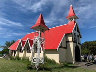
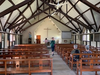
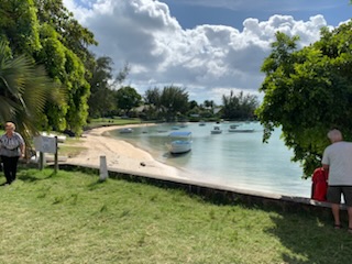
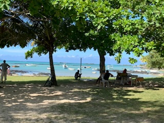
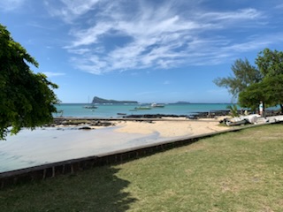
We then were driven to a general shopping mall for locals, where we had half an hour and decided that the best thing to do was to have a haircut. Obviously from now on, if I need a haircut, I’ll have to go to Mauritius!!! Our last stop was at a red roofed church, relatively simple church inside – Notre Dame Auxiliatrice Catholic Church at the northern tip of the island by the beach. A beautiful setting by the Anse la Raie Lagoon in the small village of Cap Malheureux near Paradise Cove. The church was founded in 1938 and dedicated to the Virgin Mary. The name of the cape is attributed to either A) The sinking on the ship Saint Geran on August 8th 1744 OR B) Numerous shipwrecks in the area at the start of the colonial period OR C) Where the British landed in 1810 to attack th French in a surprise ambush which led to the British taking the island, thus the French calling the area “Cape of Misfortune”, The coach then wended it’s way back to Port Louis past the fields, villages and spectacular mountains. As we did not return until after 3:45PM and had not had lunch we thought about taking the shuttle into town, but given the time the shuttle takes to get there and back, we would at most have about an hour to enjoy lunch, so we went to the Queen’s Room for tea and stayed aboard. The evening show was the very talented cellist – Kenny Martyn.