Wednesday April 19, 2023
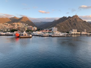
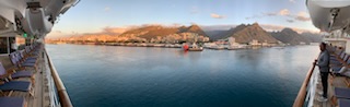
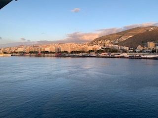
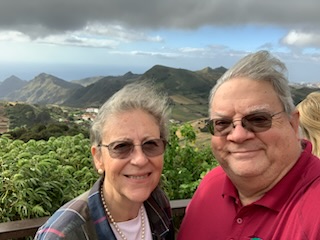
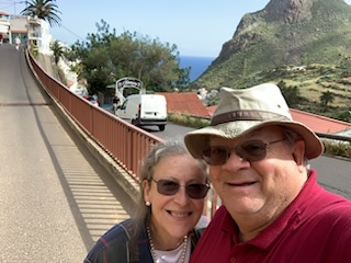
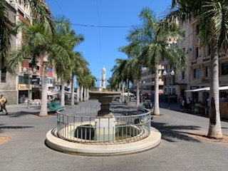
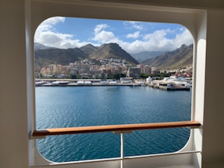
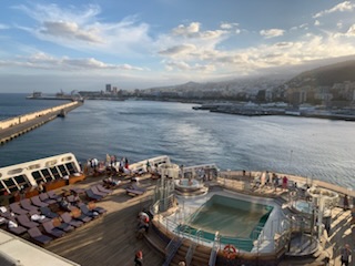
We arrived early this morning in the Canary Islands for a day on the island of Tenerife, the largest of the Spanish Island Group. We docked starboard to the dock, which is on the outside of the harbor. Other times if the ship is docked on the other side it is easy to walk into town. However, being on the outside, a shuttle bus takes you to the harbor entrance where one can cross the pedestrian bridge and end up in the main square – Plaza España.
The Canary islands are a group of basically 7 main and 6 minor (only one of these has a few inhabitant) volcanic islands that have very rugged terrain just off the coast of Morocco in Northwestern Africa. They are Tenerife, the largest and most populous with just under 1 million, followed by Gran Canaria at 850K, Lanzarote 145K, Fuerteventura 110K, La Palma 90K, La Gomera 24K, El Hierro 12K and the other minor islands – La Grciosa under 1,000 people, Alegranza, Isla de Lobos, Montaña Clara, Roque del Este, Roque del Oeste – all uninhabited. The original settlements go back 2,000 and perhaps 3,000 years ago having a common ancestry with the Berbers of the African Coast arriving on small boats. They were generally referred to as the Guanaches, who practiced mummification as some mummy’s are still in the Natural History Museum in Santa Cruz. While the islands were visited by Phoenicians, Greeks, Carthaginians, Romans and others, it seems like it was not until the 14th century that Europeans settled the islands with a mission from Majorca existing from 1350 to 1400. In 1402 the Spanish colonization started and was not completed until 1496 as Pope Nicholas V ruled that the Canary Islands were Portuguese territory, so not only were the Castilians fighting the Guanaches, but also the Portuguese. The Treaty on Alcáçovas in 1479 gave Spain the Canary Islands and Portugal, Madeira, Cape Verde and the Azores. Most of the early economic engine for the Canaries was Sugar, but eventually this was added to with cochineal and lichens to be used as dyes. By the 1800’s there was a mass migration of Canary Islanders to the Americas, mainly Venezuela but also to Cuba, Mexico, Puerto Rico and others. Today (as of 1982) it became an autonomous region of Spain with it’s own elections and government and joint capitals of Santa Cruz in Tenerife and Las Palmas in Gran Canaria.
Tenerife derives it’s name from two indigenous words – “Teni” – Mountain and “ife” – white with the “r” being added by the Spanish, so White Mountain (Tenerife) as the highest peak often is covered in snow. Tenerife is home to 297 volcanos mostly monogenic (only one eruption) with only 1 which is still active. It is home to the 3rd largest volcano in the world (after the ones in Hawaii), if measured from sea floor to top of the peak and that is Mount Teide, which is 3,718 Meters (12,198 feet) above sea level. The name “Canary”, is sometimes thought of as coming from Canary birds, but is more likely to come from the Latin – “Canaria Insulae” – Island of the dogs as Pliny indicated that there were a lot of dogs on the islands. The name “Canary Wharf” in London is so named as that is where the sugar proceeding from the islands arrived in London.
Horacio Nelson attacked Santa Cruz de Tenerife on July 25, 1797 but lost 400 men in the battle and a canon that was fired hit Nelson and he lost his arm.
We boarded the Coach 6, driving on right hand side of the road, with the excellent guide Ana and driver Pedro, for our tour “Northern Panorama” which basically went from the main town Santa Cruz de Santiago de Tenerife, north over the volcanos to the north east coast and then around the northern perimeter returning to the Port. The reason for the name was that it was first discovered by the Europeans on May 3, 1494 which was the day of the Holy Cross – Santa Cruz then taken by Lord Nelson on July 22, 1797 the day of Santiago and Tenerife which in the local aboriginal language was White Mountain given the snow on the top of the tallest peak Mount Teide. We drove through the town, past the impressive Opera house built by a Lanzarote Architect and bears some resemblance to the Sydney Opera House, but looks like one large wave coming to a point over the main structure. It is iconic and a picture of it clearly states this is Santa Cruz! We also passed two oil drilling platforms that were in the dock area obviously being serviced.
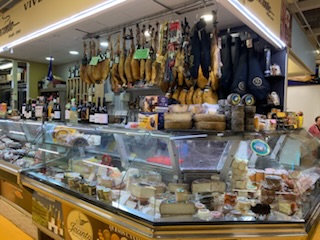
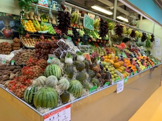
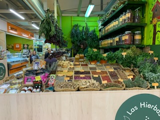

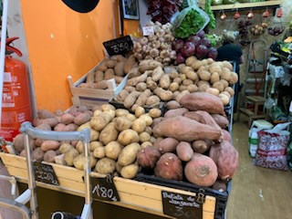
Our first stop was at La Laguna (actually San Cristobal de la Laguna) which was the original capital of the island as it was away from the coast and easier to defend as the cannons from seafaring vessels were not able to reach the town. We stopped at the food market and saw the very colorful and very clean market with it’s potatoes (there 29 types), fruit and vegetables, meat, spices etc. Off the main square there is a small church – San Francisco Real Santuario del Santisimo Cristo de la Laguna. Which is next to a military installation with the emblem of crossed cannons above which is a crown and in large letters “Todo por la Patria” (everything for the country). The town is also home for the University of La Laguna established in 1792 currently has some 20,000 students.
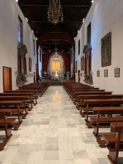
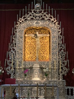
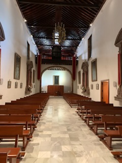
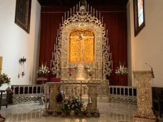
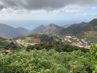
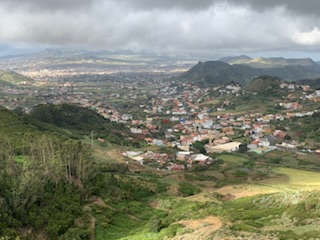
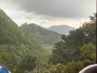
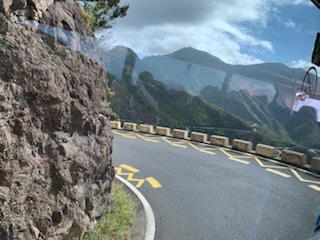
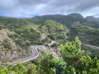
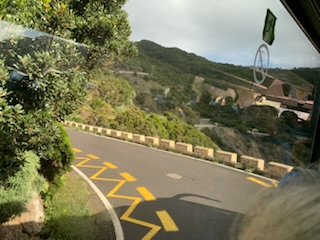
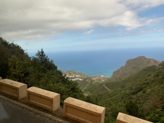
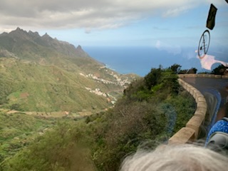
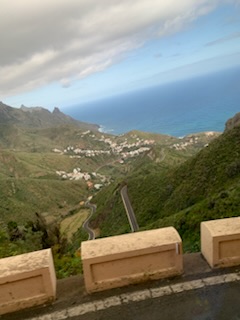
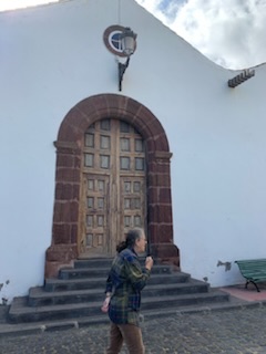
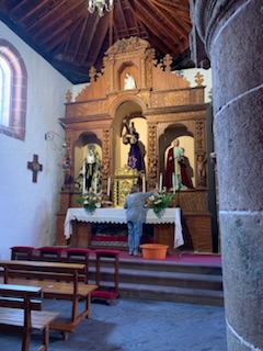
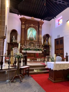
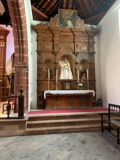
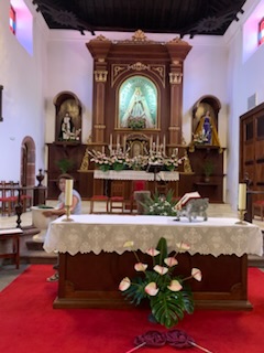
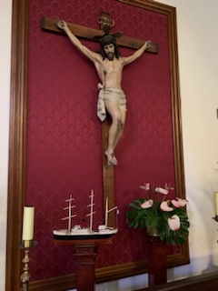
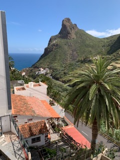
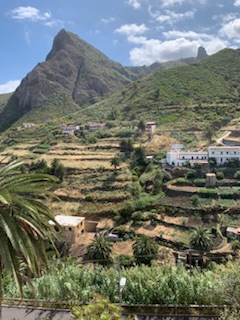
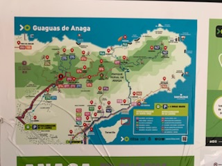
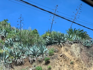
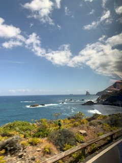
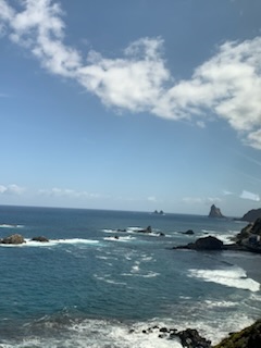
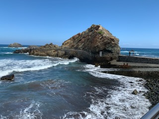
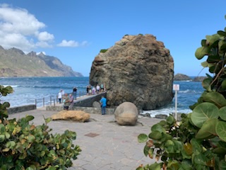
We then continued on the TF12 road up the volcanos to a scenic overview near Las Mercedes over the surrounding area called “Mirador de Jardina” (garden overlook) overlooking La Laguna in the Rural park of Anaga, and in the distance the ocean. It was a spectacular day from a weather standpoint with clear views for miles. We then continued up through the primordial forest (it is the same as it was for millennia untouched by humans) up the very narrow, sinuous, somewhat scary road. The coach had to make other vehicles back up and it was tight to get around the curves. Steep drop offs on both sides made the views from the coach absolutely spectacular. Continuing through the forest climbing to 2,000 meters (the highest peak Teide is 3,718 meters) we turned onto a secondary road TF134 which was narrower and more curvy to go down the volcano until we reached the town of Taganana where we stopped at the Xiomara restaurant and viewpoint for some local cheese and at 10:30 AM we enjoyed our first glass of local wine!! After seeing the views and partaking of the food, we walked up the hill to the village church – Nuestra Senñora de las Nieves – Our lady of the snows – a very attractive small church that has a unique triptych relaying the birth, the arrival of the Magi and the presentation of Christ at the temple. It is unique as no-one knows who painted it and indeed up until relatively recently it was displayed as three different paintings, until a parishioner stated that he thought they were actually one unit. Ever since then it was put together and displayed on one of the side walls. It is probably Dutch as there was much trade with the Dutch and in 1599 a Dutch fleet of 74 ships and 12,000 men attacked Las Palmas de Gran Canaria. The other interesting feature that the guide pointed out was a crucifix at the bottom of which was a model of an old Spanish Galleon. The story has it that the large (6 ft) crucifix was on a ship destined for Venezuela when the winds became unfavorable and it was shipwrecked off the coast. The locals salvaged what they could and some were saved, one of which was the crucifix. Thus the model of the ship represents the ship that was destroyed allowing the Crucifix to remain in the town of Taganana.
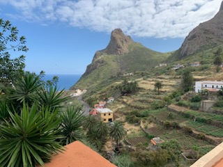
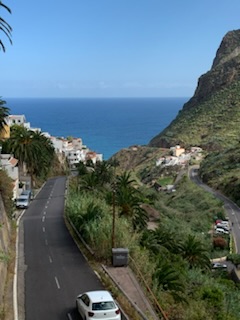
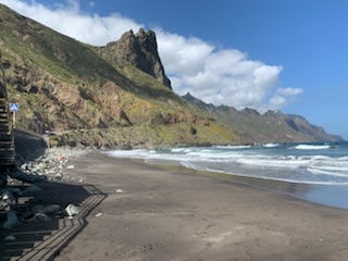
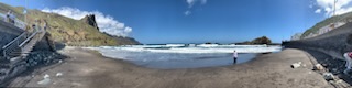
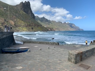
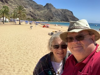
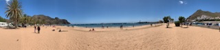
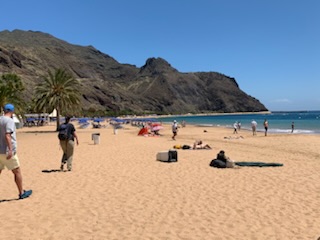
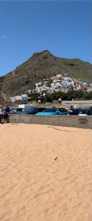
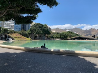
We returned to the coach and continued along the road to the town of Almaciga and the beautiful beach and bay with it’s black (volcanic) sand. After wandering around the one street and beach, we boarded the coach for the return up the sinuous mountain road to the turn off at El Bailadero taking Route TF12 through the forest to the south shore and the town of San Jose where we went to the Las Teresitas Beach. Here the sand was yellowish / orange as the local government decided to import thousands of tons of sand from the Sahara Desert to make the (non-black) beach. A very attractive beach with all the facilities. However not many people in the water as it is cold and there are severe currents that make swimming not advisable. Something like 85 people were drowned last year of which 80% were tourists. Once back on the coach we were soon back at the port where the coach left us off just by the ship.
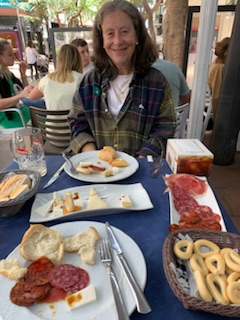
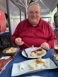
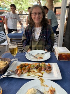
We immediately got onto the shuttle as we had a 2 PM reservation for lunch. We were left at the entrance to the harbor and walked over the pedestrian bridge to Plaza España and veering to the right we found the Calle San Jose and the restaurant. We had a really nice lunch and a few local beers at Restaurant Lateral 27 on Betancourt Alfonso #27 (Phone 922-28-77-740) which was recommended by the tour guide Ana who kindly made a reservation for us although when we got there it was not really needed. It is at the top of an inclined pedestrian street previously called the Calle San Jose which is filled with lots of restaurants and shops.The waitress was from Venezuela and suggested based on our choices some modifications to our order. What she did was brilliant as had we gone with our original thoughts we would have wasted a great deal of food. After the really nice lunch, we wandered around the town, stopping in a couple of shops and sights until it was time to wander back across the Plaza España bridge to the port and catch the 5 minute coach ride to the ship.
A really amazing day, perfect weather and great tour and lunch. We watched the sail away, which was late, but only a couple of hours late and after a light snack in the cafeteria, we retired for the evening.
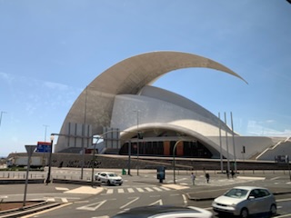

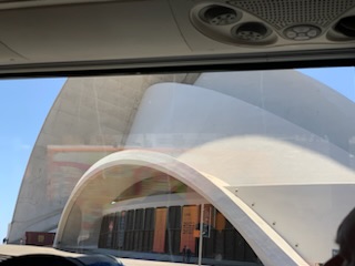
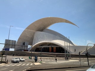
The iconic Opera House.
